
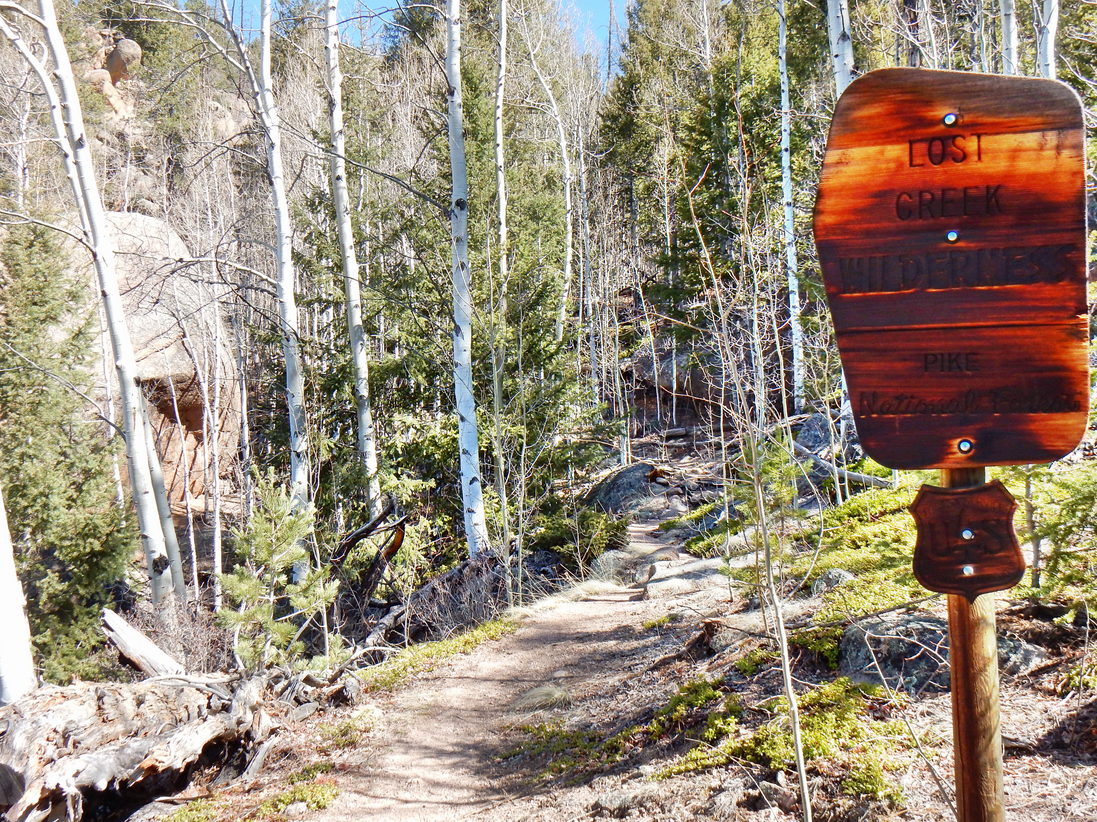
My target for the day was McCurdy Mountain (12,173’) in the Lost Creek Wilderness. The Lost Creek Wilderness (LCW) is a gorgeous area which possesses a treasure trove of stunning rock formations. Despite the majesty of LCW, I’ve only seen two other people combined on my four visits now! I’ve felt the magnificent magnetism of the Lost Creek Wilderness since summiting Bison Peak a few years ago (Bison Peak). Upon entering the Lost Creek Wilderness, my internal compass needle weaves a beautiful tapestry of freedom and escape. The free-flowing spirit of my human compass has now twice gotten me inexplicably lost or far off course in the depths of the area’s unforgiving terrain. Despite these misadventures, my heart pulsates for the Lost Creek Wilderness.
My understanding of physics and science is admittedly subpar, but the term ‘polarity’ is perhaps the best way to extend my description of the complex experiences I’ve had with the area. One of the definitions on Dictionary.com of ‘polarity’ is as follows: “the positive or negative state in which a body reacts to a magnetic, electric, or other field.” The way the fields of mind till the lands of the Lost Creek Wilderness are diametrical opposition from everyday life and perhaps logic.
Ok, thanks for indulging me on the nonsensical drivel of the prior few paragraphs! The LCW is a tremendous area and is somewhat of a diamond in the rough as far as I’m concerned. What I was trying to convey is that the area possesses incredible beauty, but is always wild and unforgiving if one ventures off course. The first time I got lost in the area was last May when I found my heavily-shaded trail covered in snow. A series of questionable decisions compounded with my lack of preparedness made that day into a bit of a mess. I was far more prepared when hiked/snowshoed up Bison Peak in the snow for the second time back in December from the Ute Creek Trailhead. However, today’s travels went far less smoothly again!
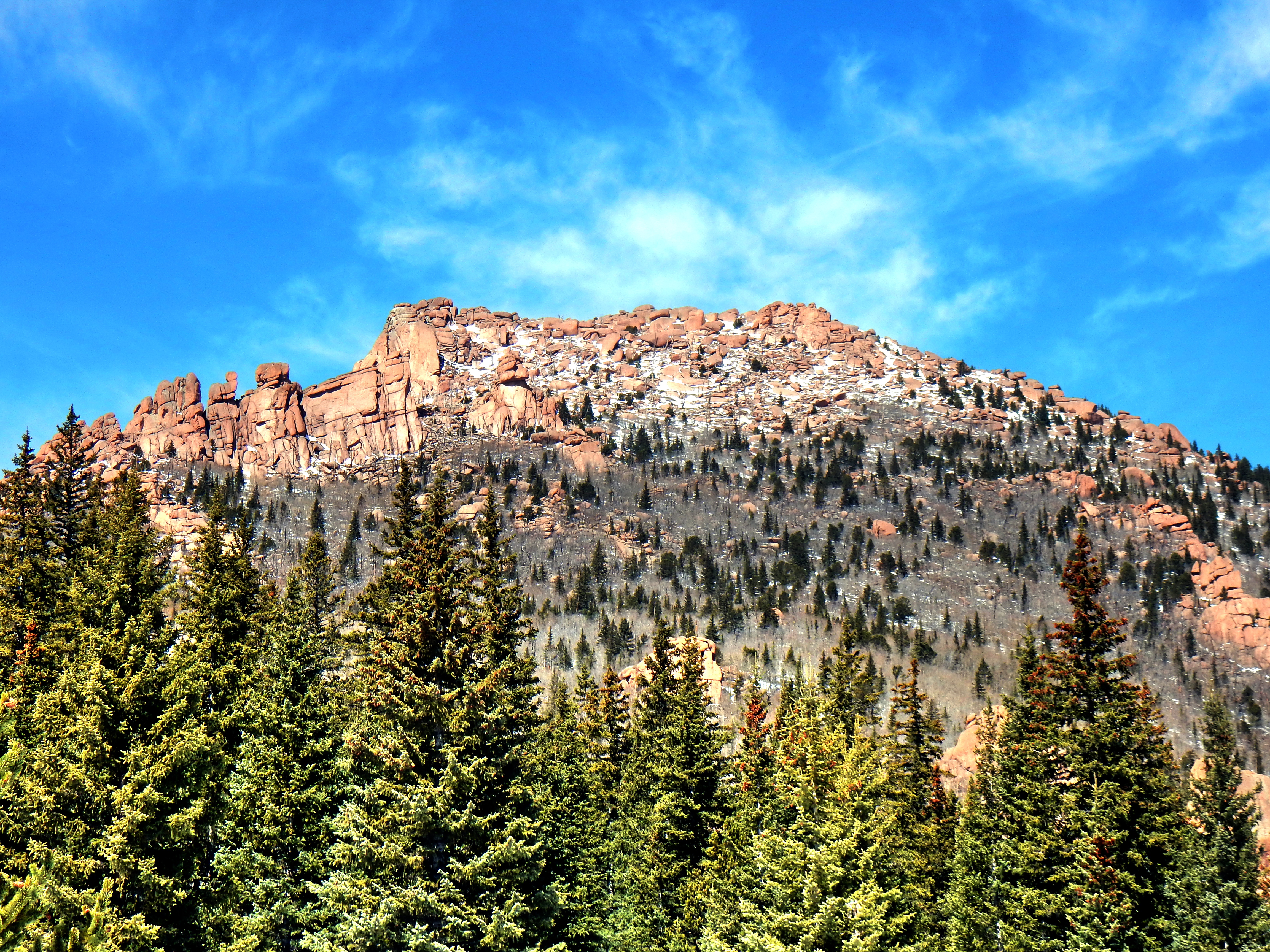
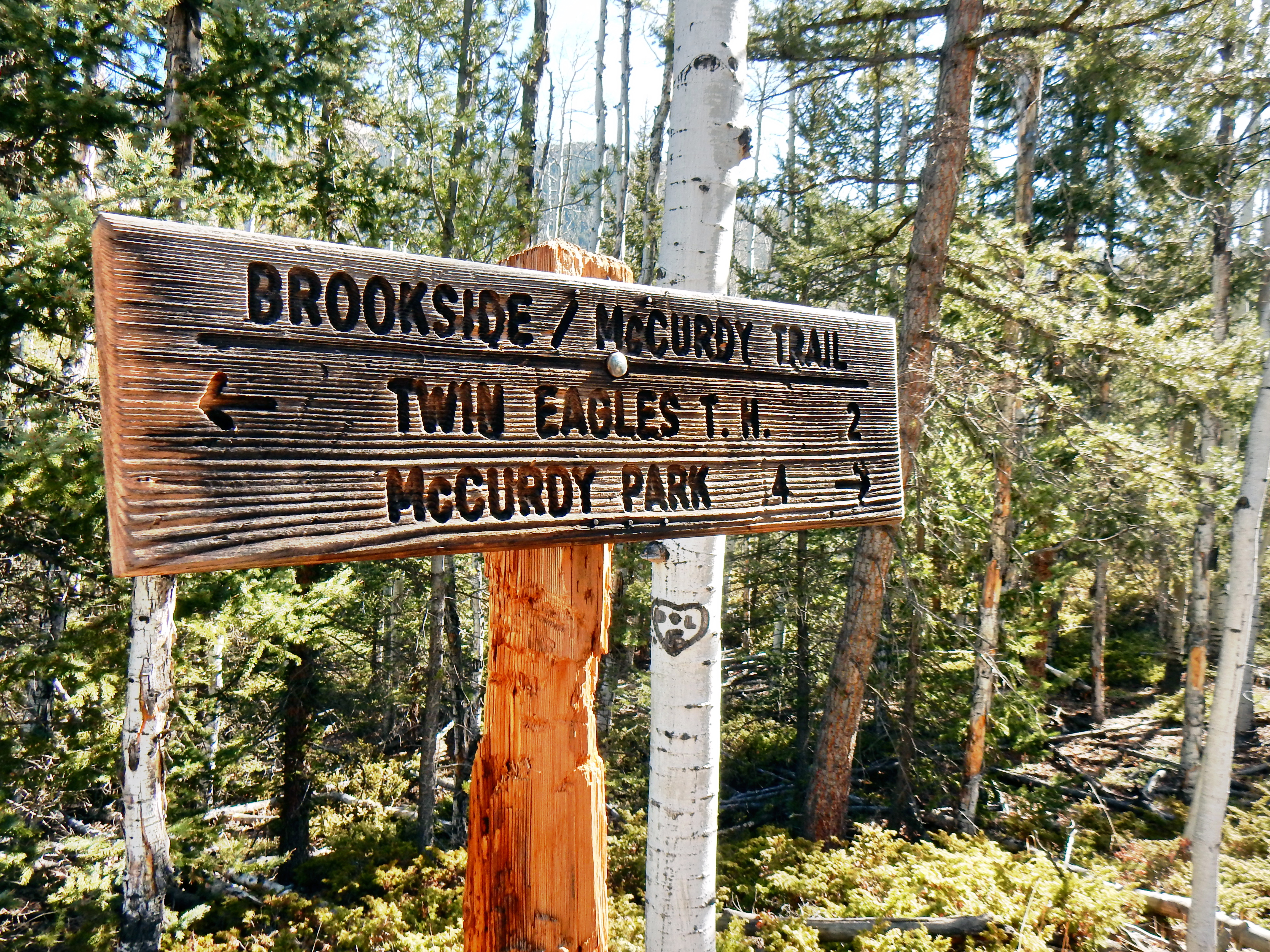
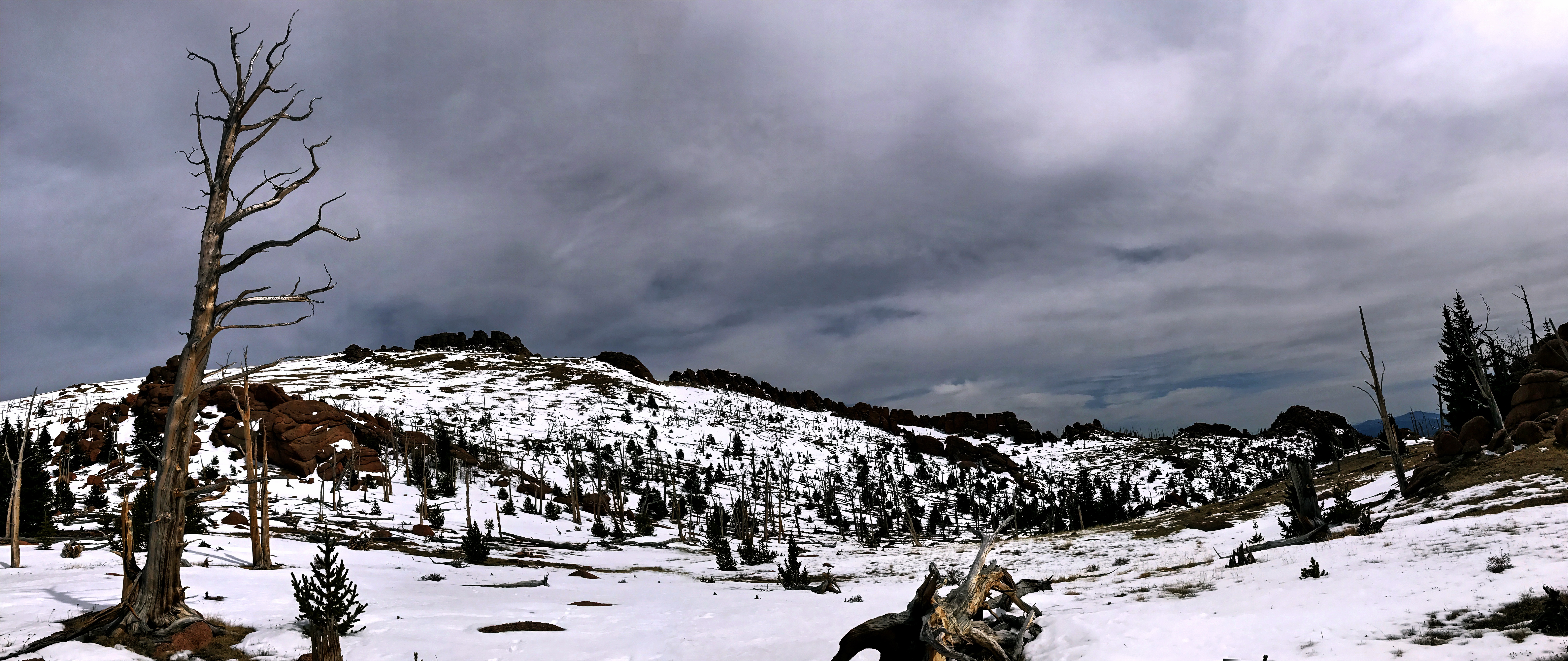
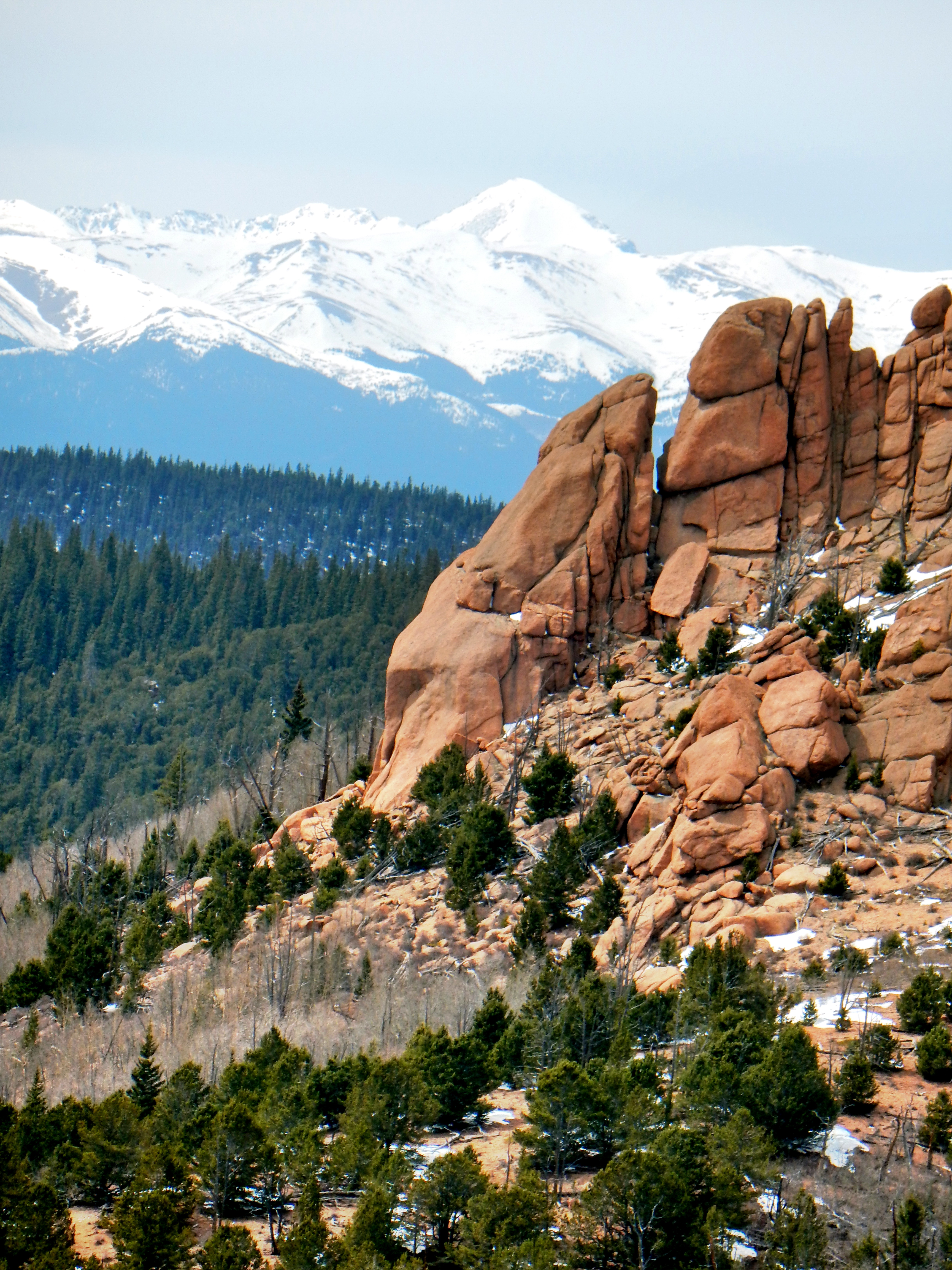
Without further ado, let’s jump into the madness that my day became…Since I had used Ute Creek Trail twice before to climb Bison, I decided to start from the Twin Eagles Trailhead in pursuit of McCurdy Mountain. Right from the start of Twin Eagles, one can see McCurdy Mountain and a lot of the wild playground that is the Lost Creek Wilderness.
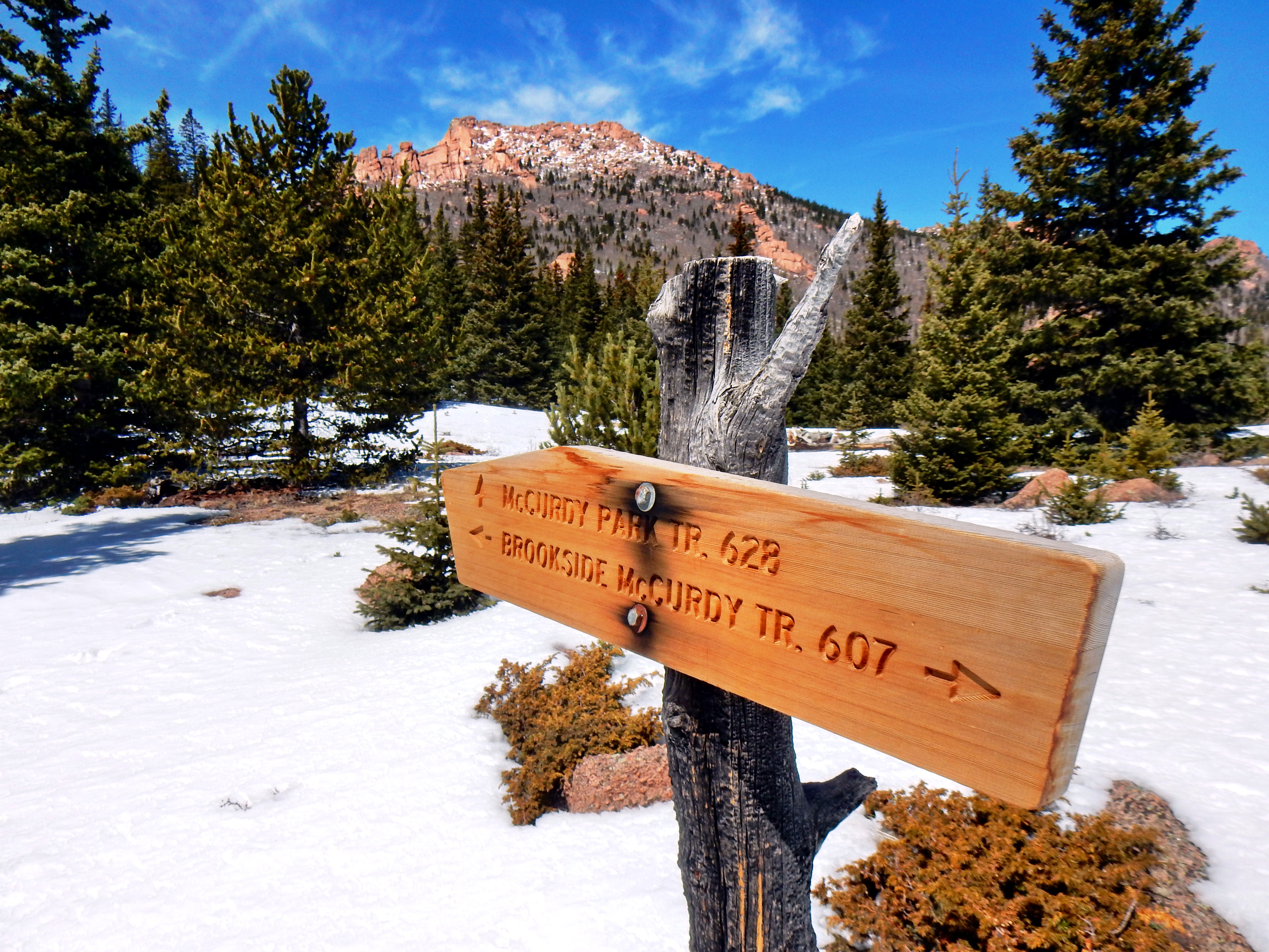
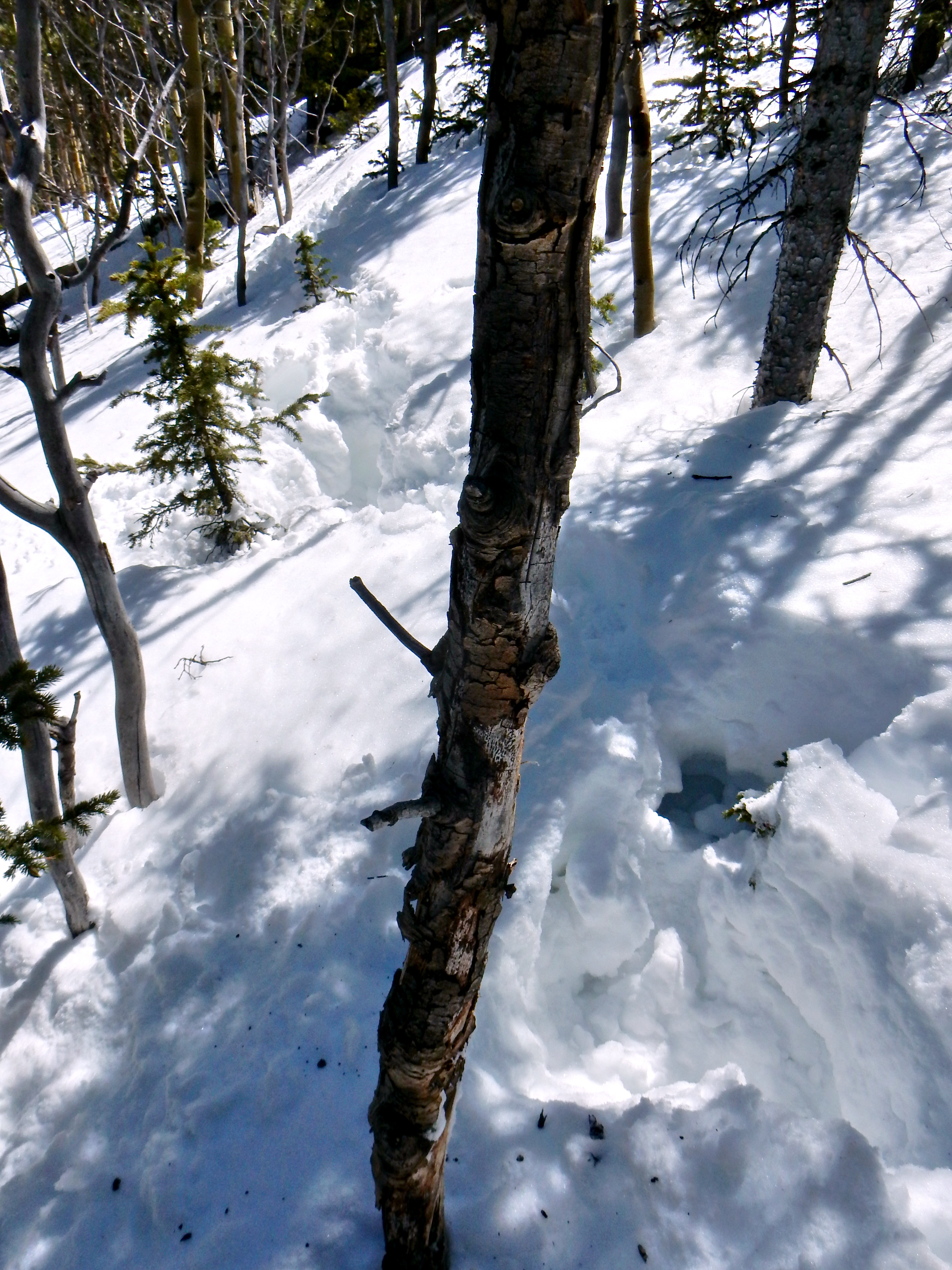
With the mistakes of my prior trip to LCW firmly in mind, I packed my backpack full of water, snacks, two jackets, pants, winter gloves/hats, Kahtoola MicroSpikes, and even maps! Why didn’t I bring snowshoes? That was a question I asked myself during my hours intermittent post-holing! After ascending the trail from the McCurdy Park Trail junction, the snow became much deeper and less crusted over. My first attempt up was on the main trail, which resulted in post-holing up to my knees with each step! It was a true exercise in futility and clearly wasn’t going to work. It took me several minutes to reach the shores of stability as I had drifted too far into the sea of snow.
Once I got back to solid footing, I contemplated turning around and heading to explore McCurdy Park since I was so close to the trail. I was already seven miles into the day as I recall, so turning back seemed to waste all my efforts. Alas, I very reluctantly decided that I would turn back. Right after I made this decision, I saw some small animal tracks adjacent to the trail. I decided that I would give this alternate path a try before turning back. I remember thinking it was cool that I could find a better path from the animal tracks and feeling a true connection with nature.
Phoomph! Yep, my connection with nature was deep! So, I decided my trip to McCurdy Mountain was over. It wasn’t a difficult decision as the trail cut appeared to promise an endless pitch of post-holing. Plus, I was only wearing shorts and my hands were very cool after digging myself out of many holes. When I got back on the trail, I was tired and cold; so, I regrouped with a snack and some water. I also got out my gloves and jacket, which quickly made me feel much better. In fact, I felt so much better that I lost my ability to properly reason! (The LCW Polarity effect).
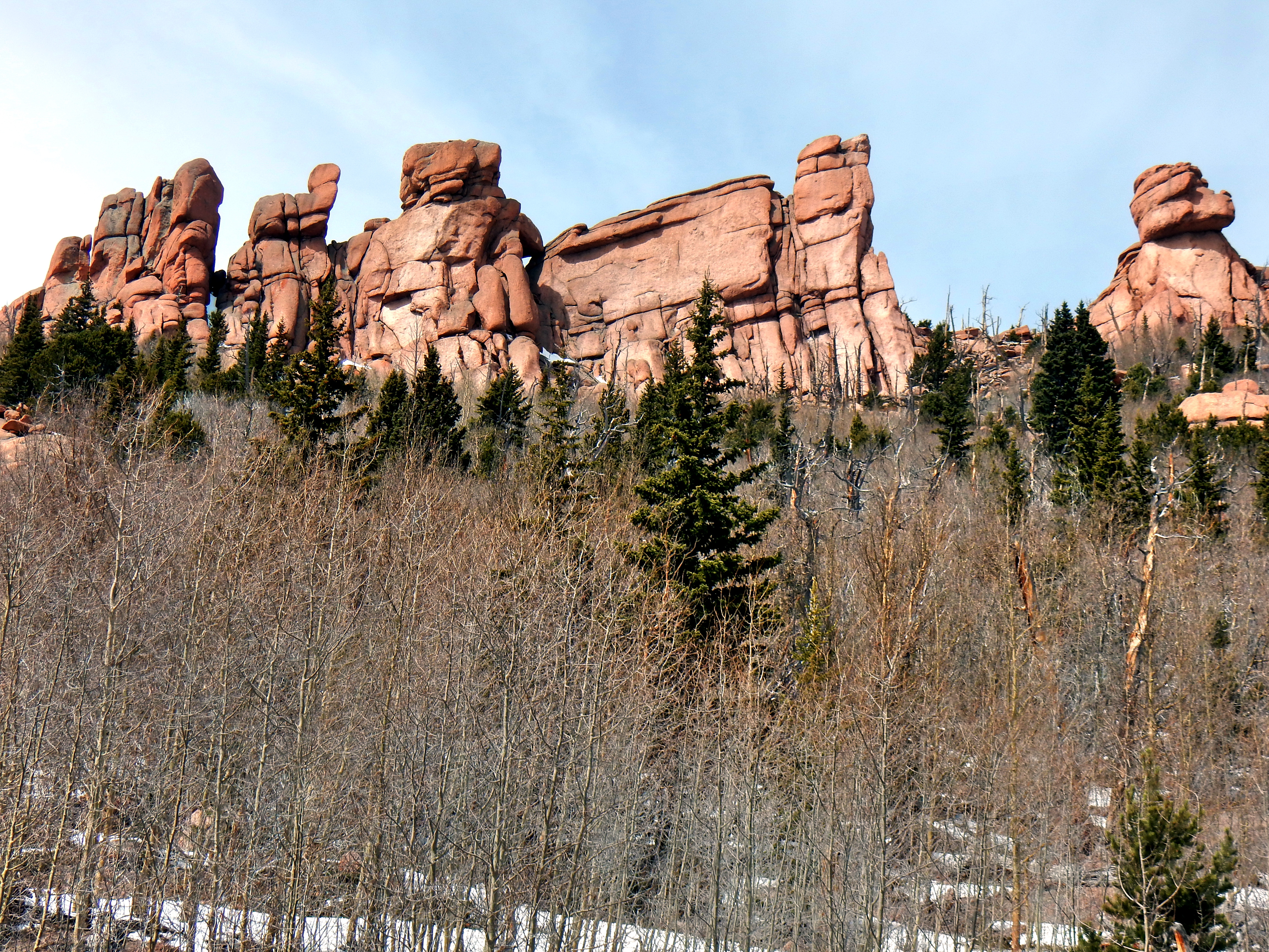
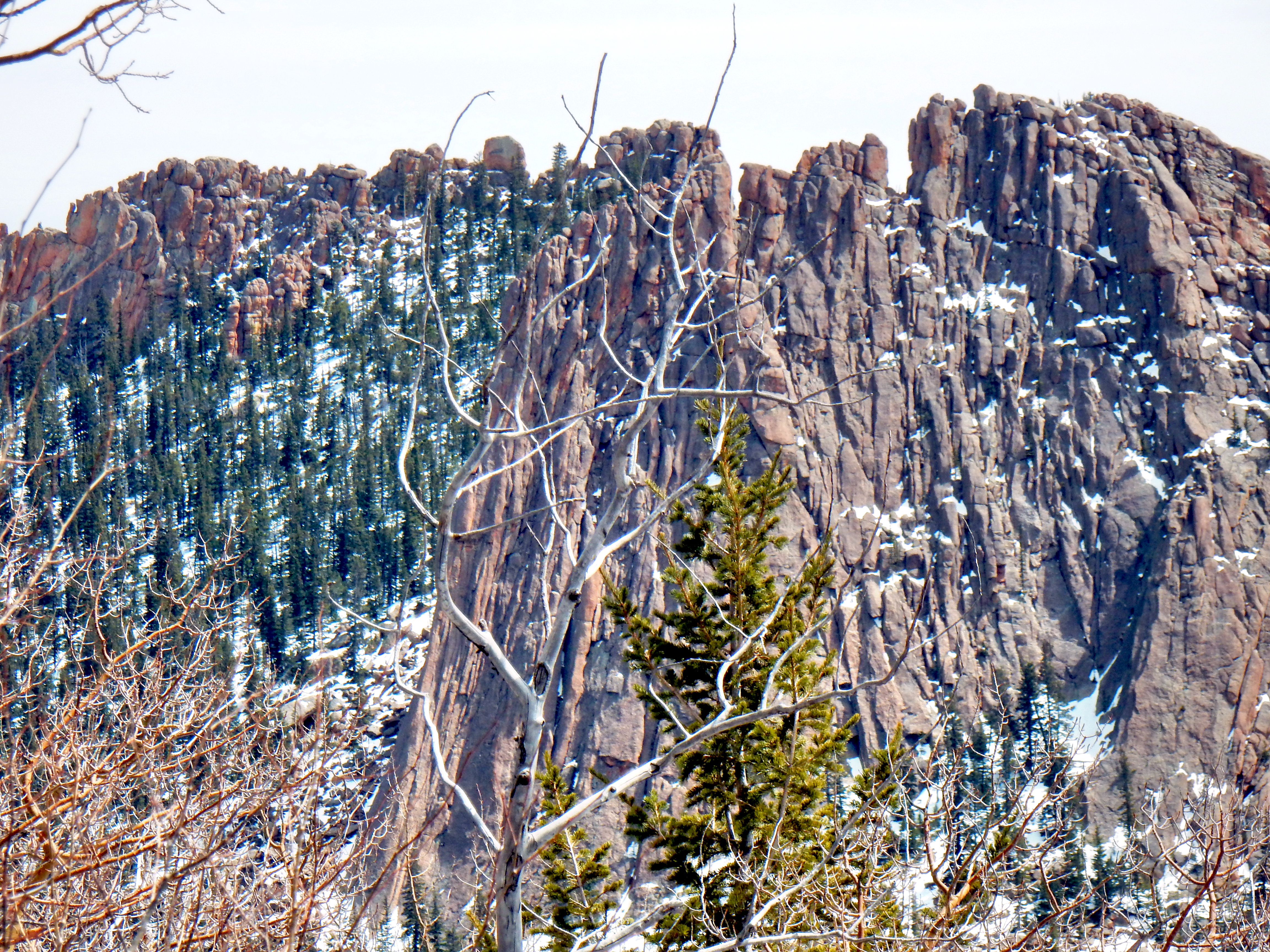
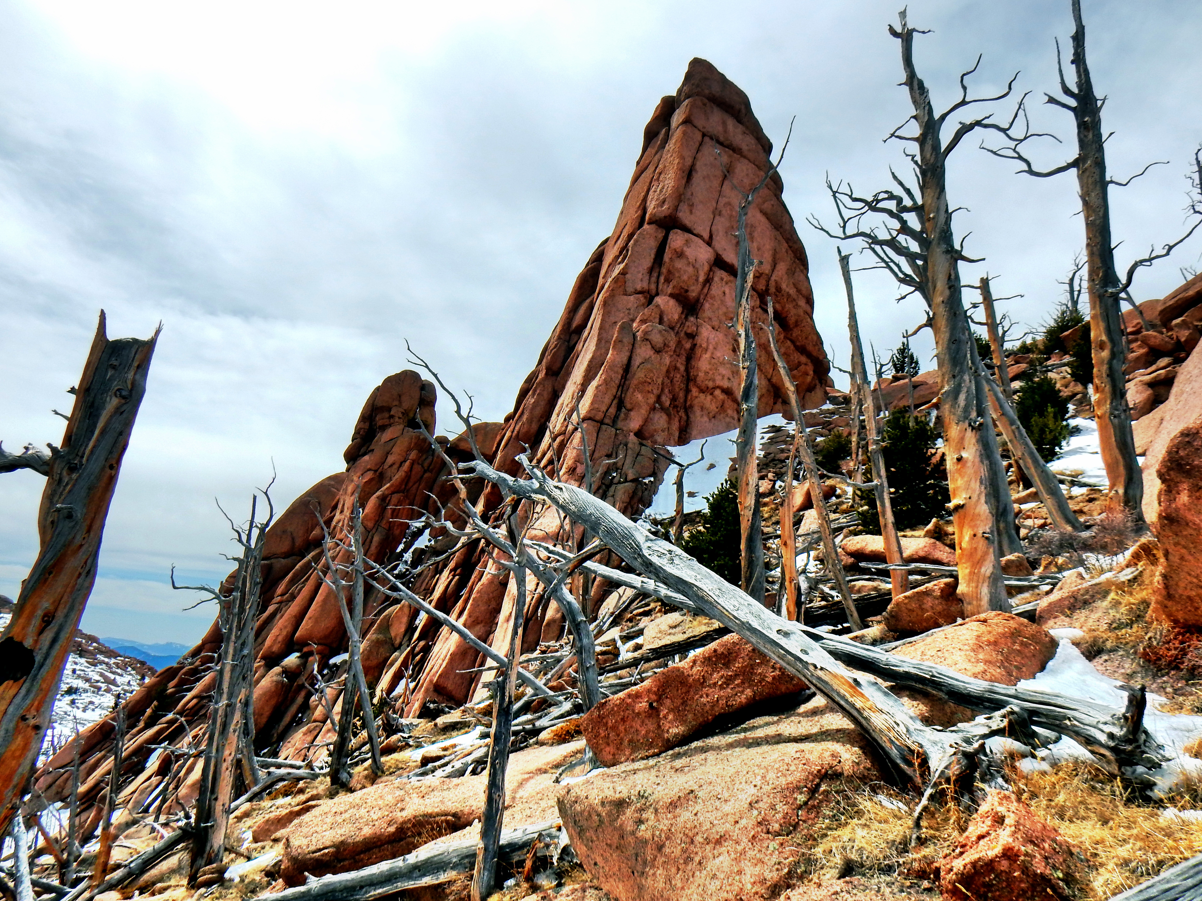
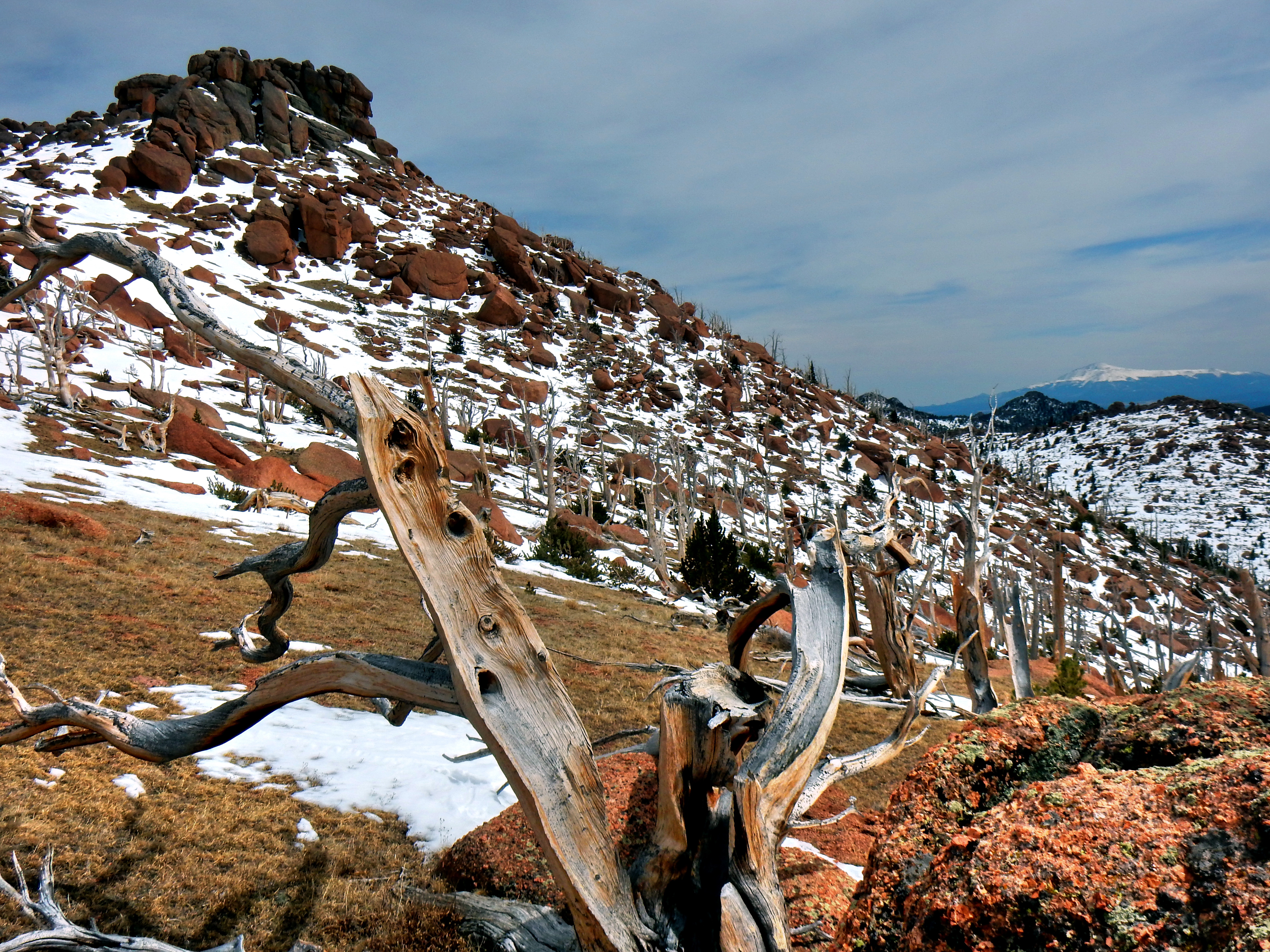
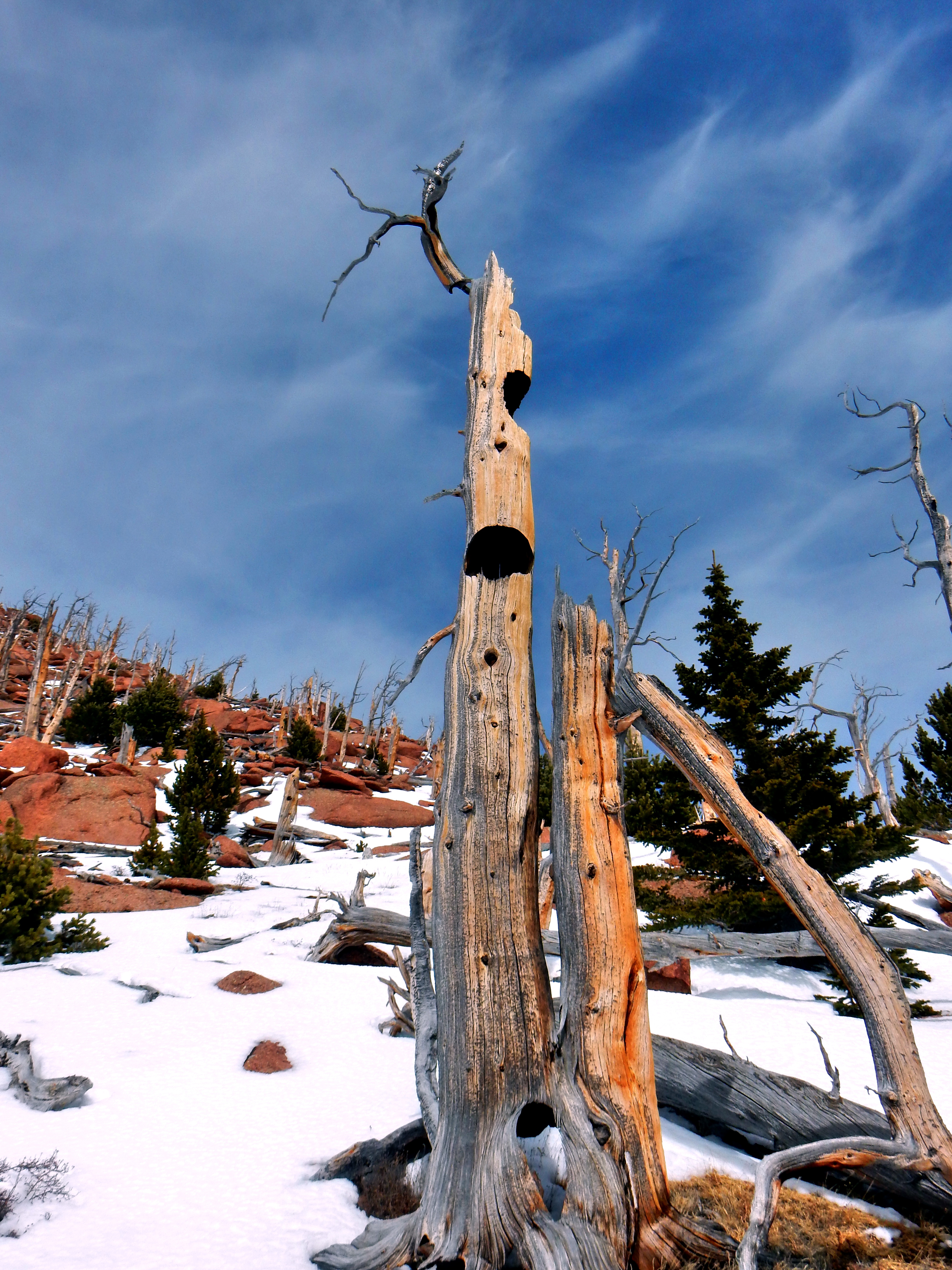
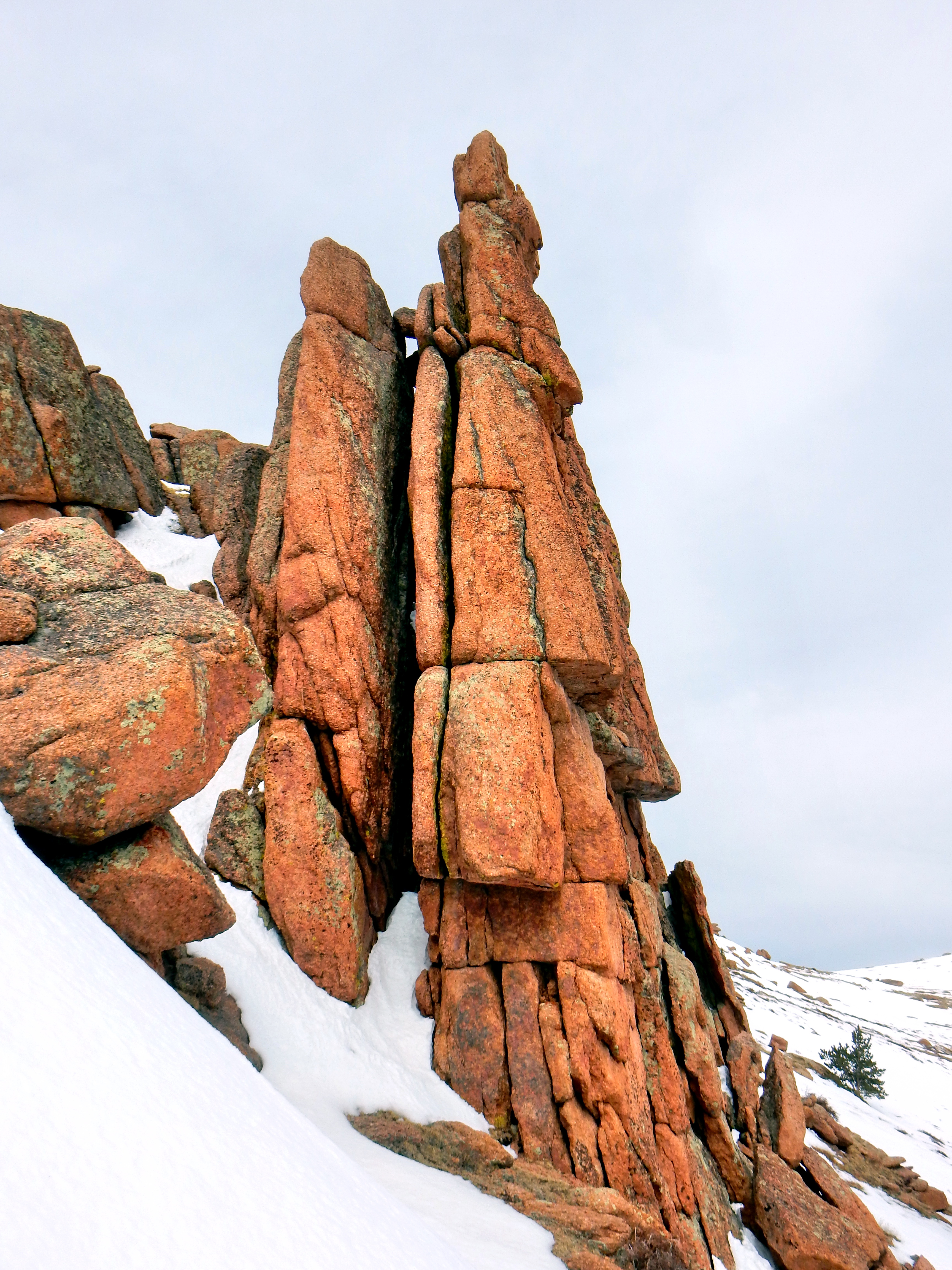
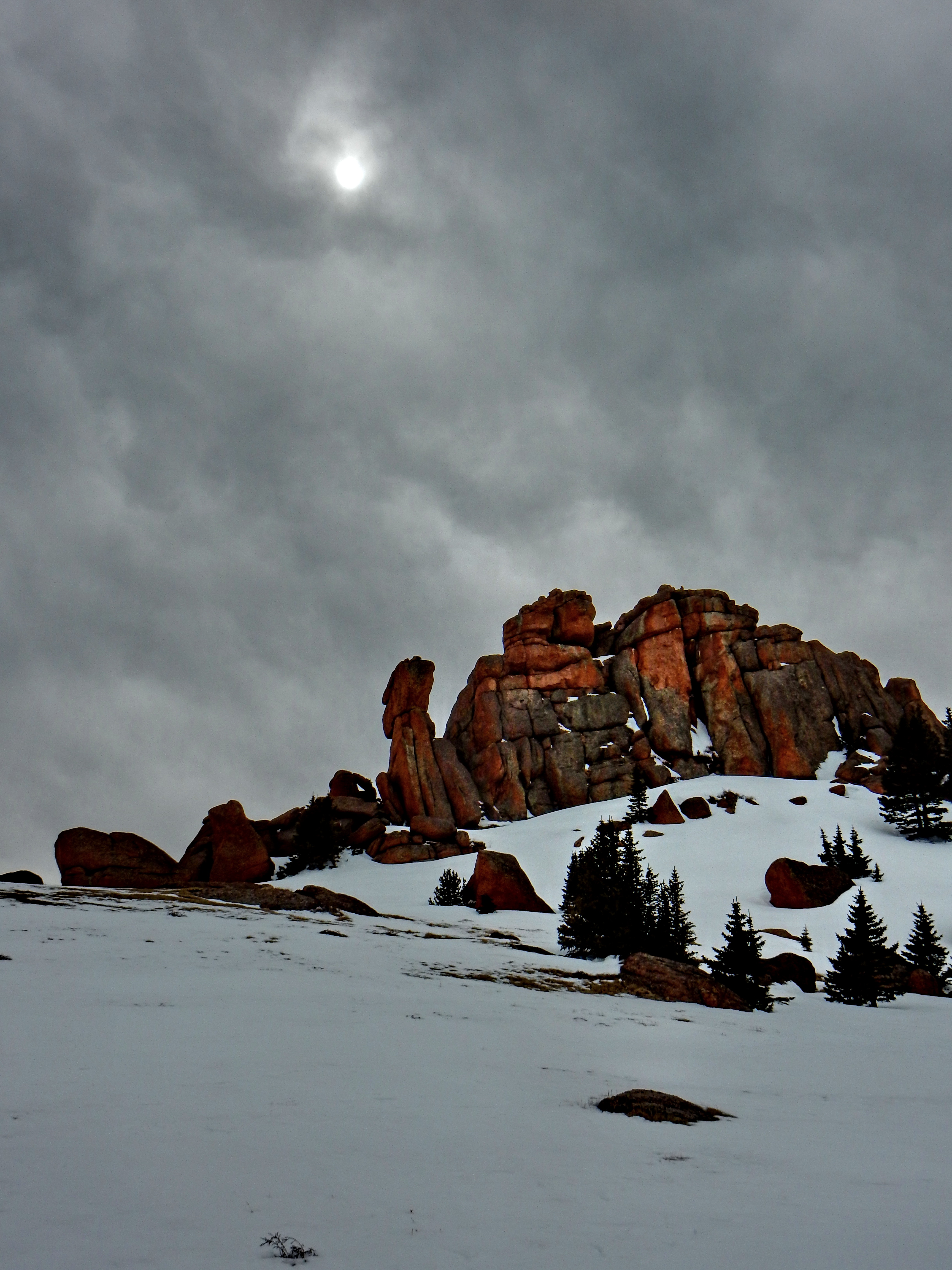
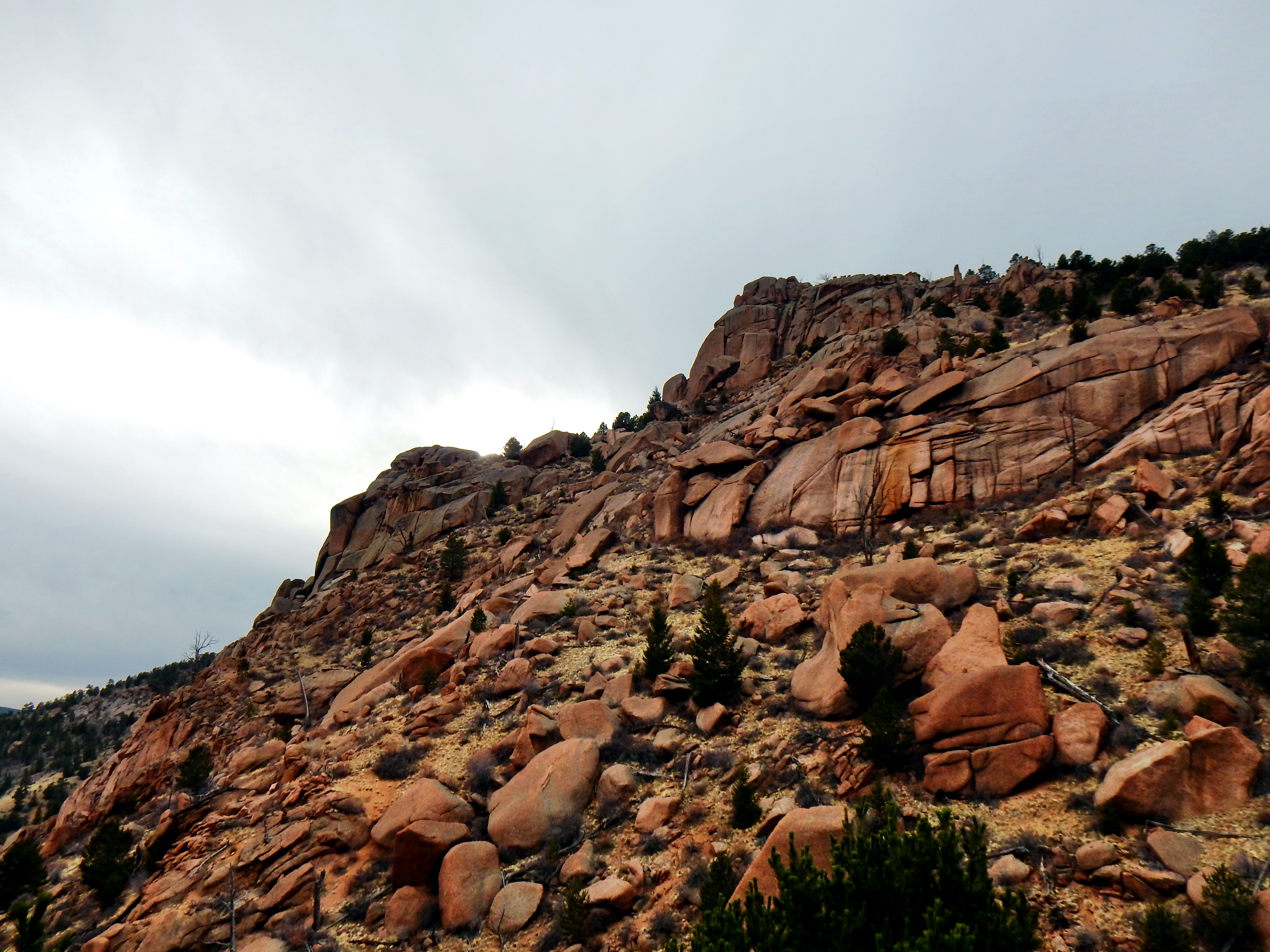
I started back toward my post-hole folly with renewed energy and determination. I quickly found my pursuit to be equally idiotic, but my response was different this time. I grasped Aspen tree trunks to avoid falling to my prior depths when possible. With my ski gloves, I was less annoyed with plopping down when I could not find any trees. This stretch took a lot of energy and left me at a deficit for the rest of the day. However, I soon found the snow to be solid as I spotted a red rock wall on McCurdy Mountain ahead.
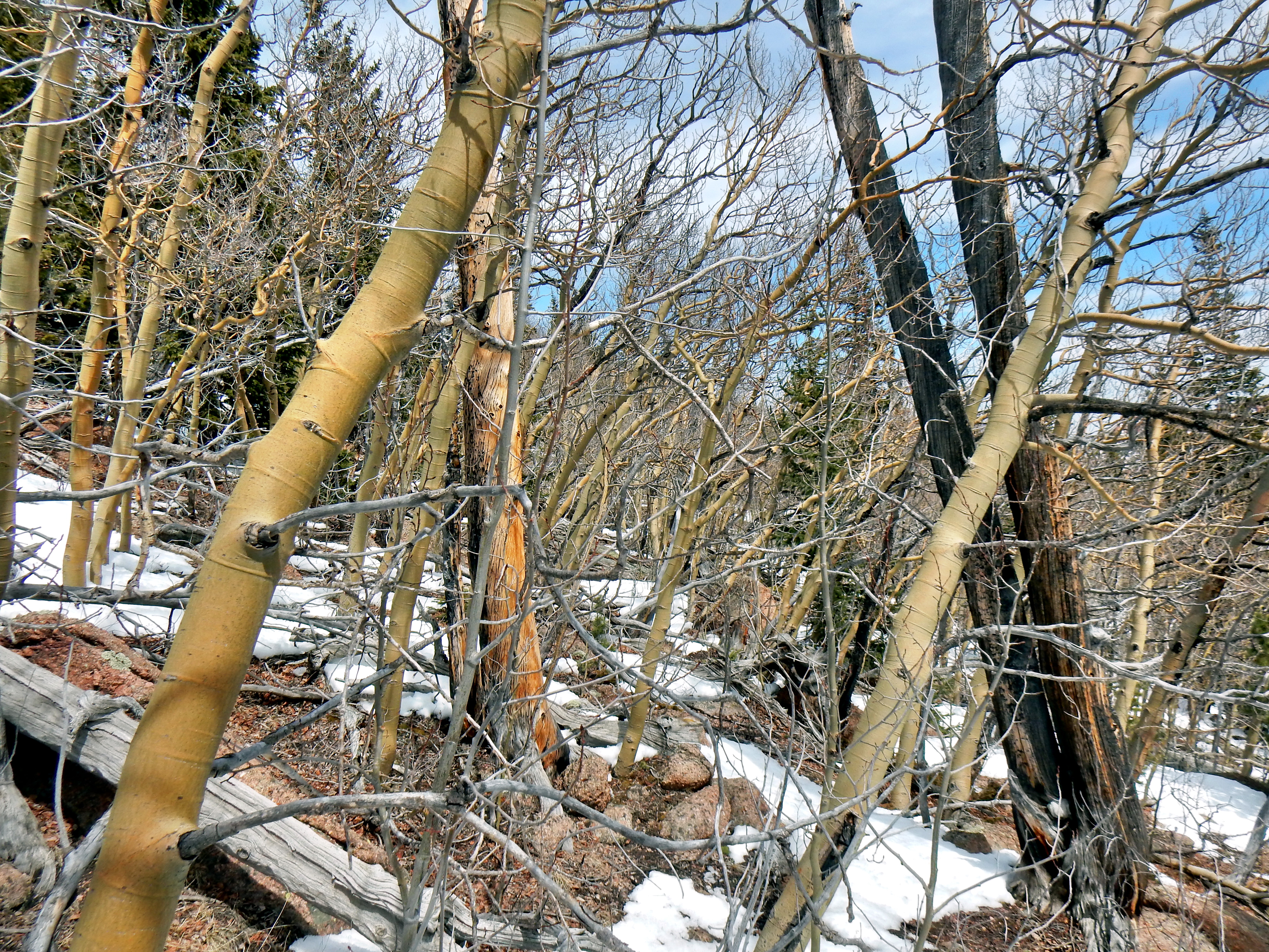
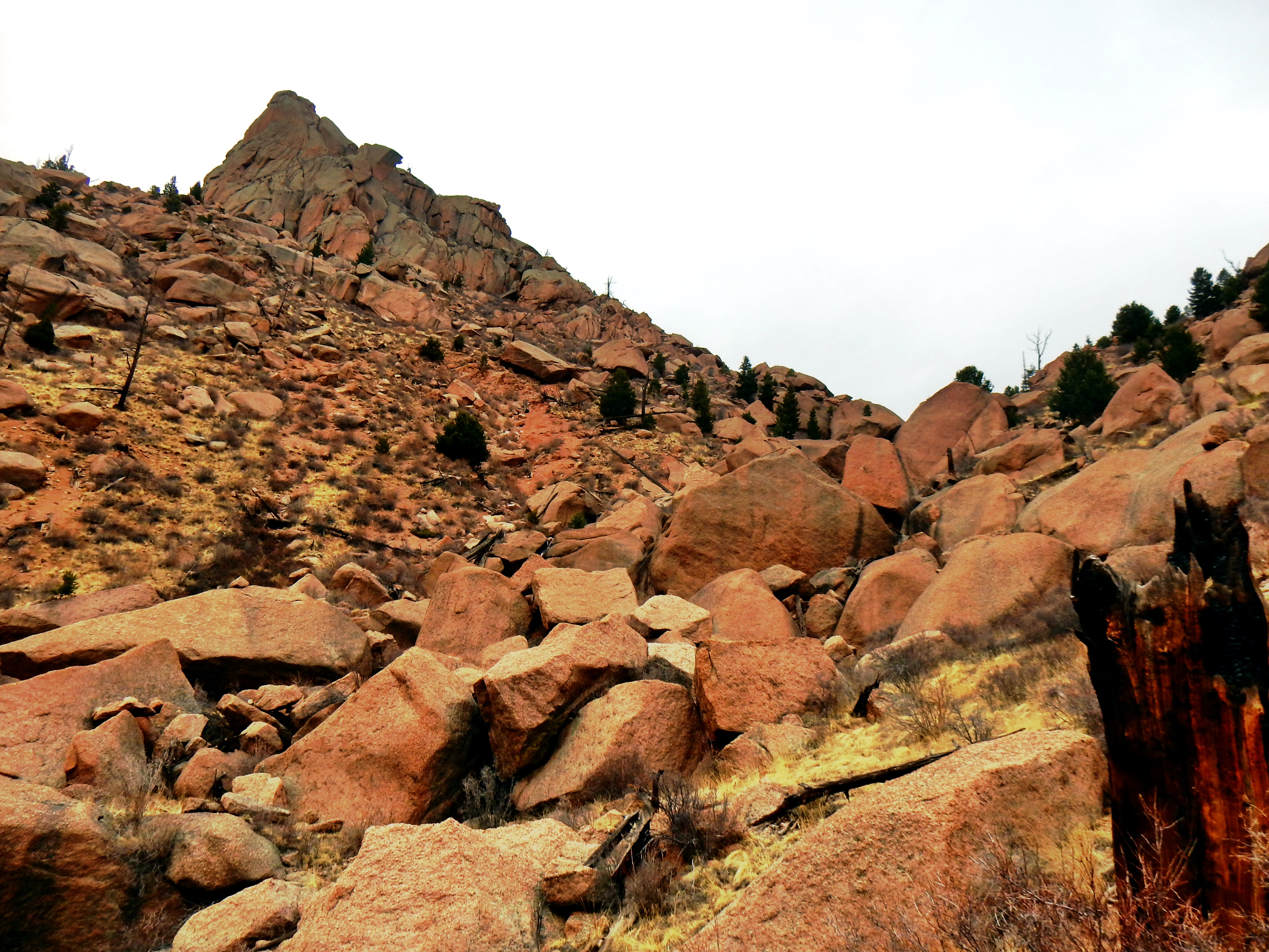
The next section presented a new challenge with its dense Aspens, wealth of down timber, and rock slabs. At that point, anything was a welcome change from the prior stretch of soft snow though. My legs were already chafed or freeze-burned (not sure if there is a term for this?) from falling through the snow, so I didn’t really care about the new scraps I was accumulating on the way up. I sought out the route with the least amount of snow as I approached the first set of rock formations. Luckily, the density of trees lessened slightly as I neared the top.
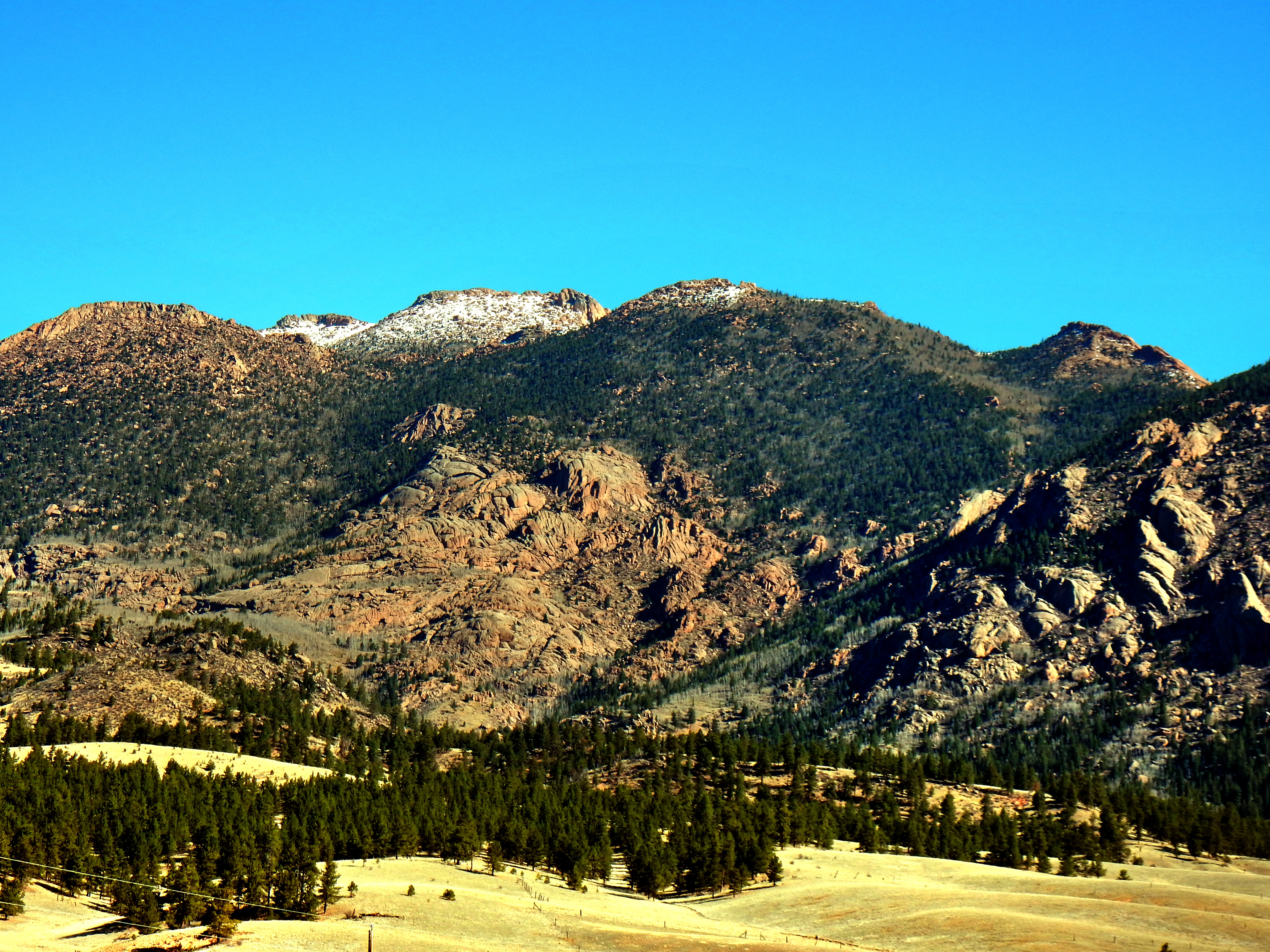
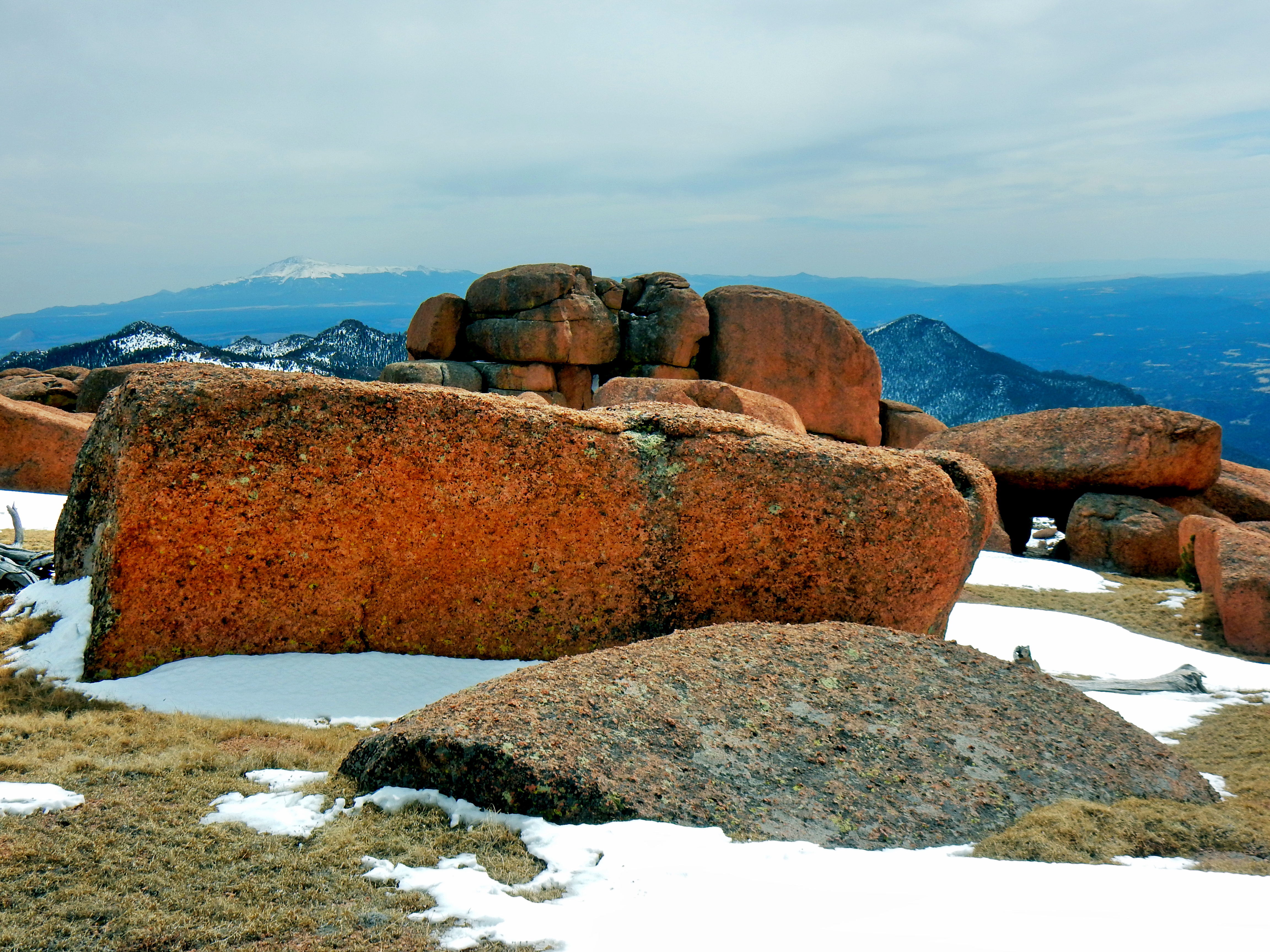
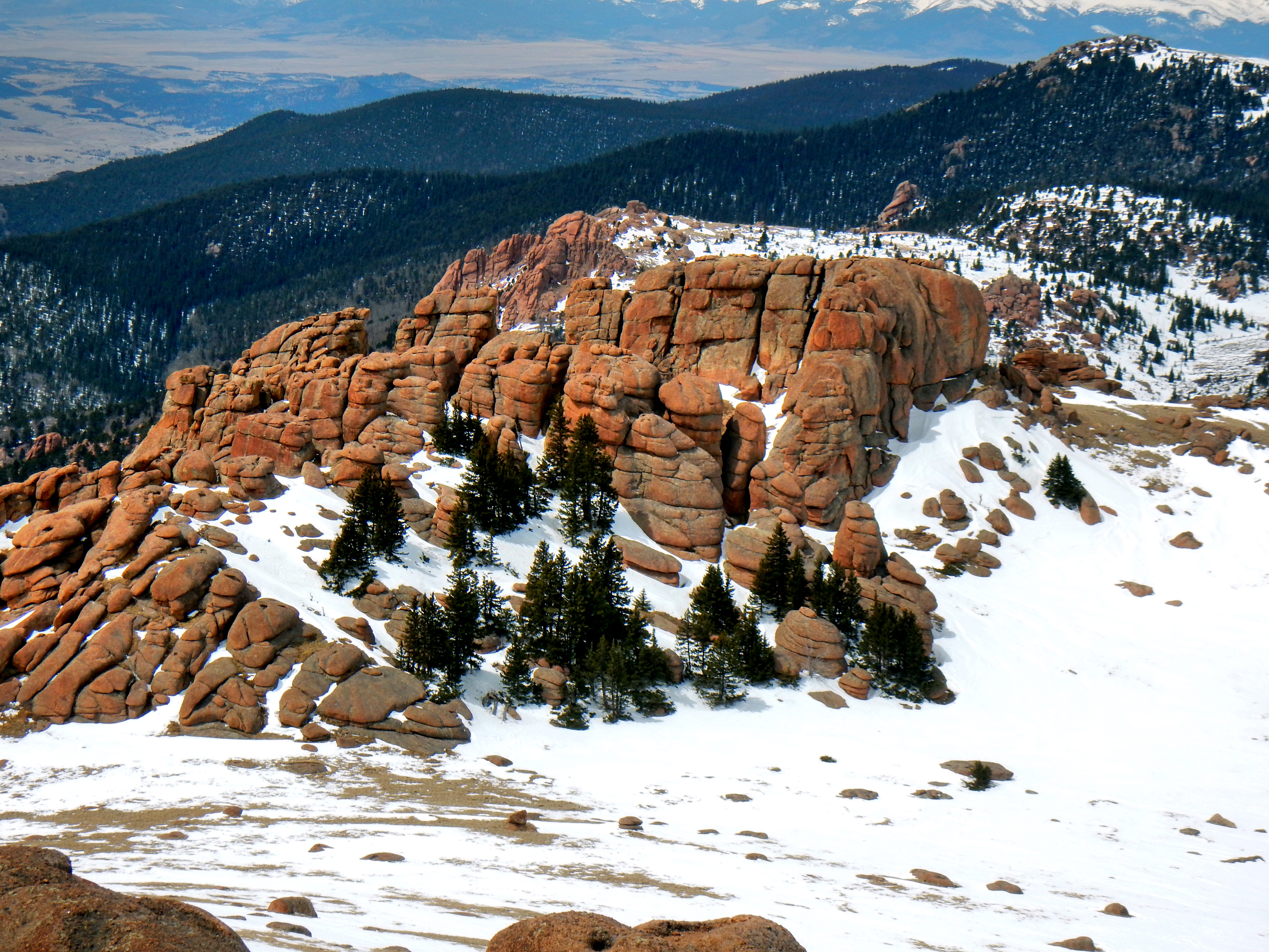
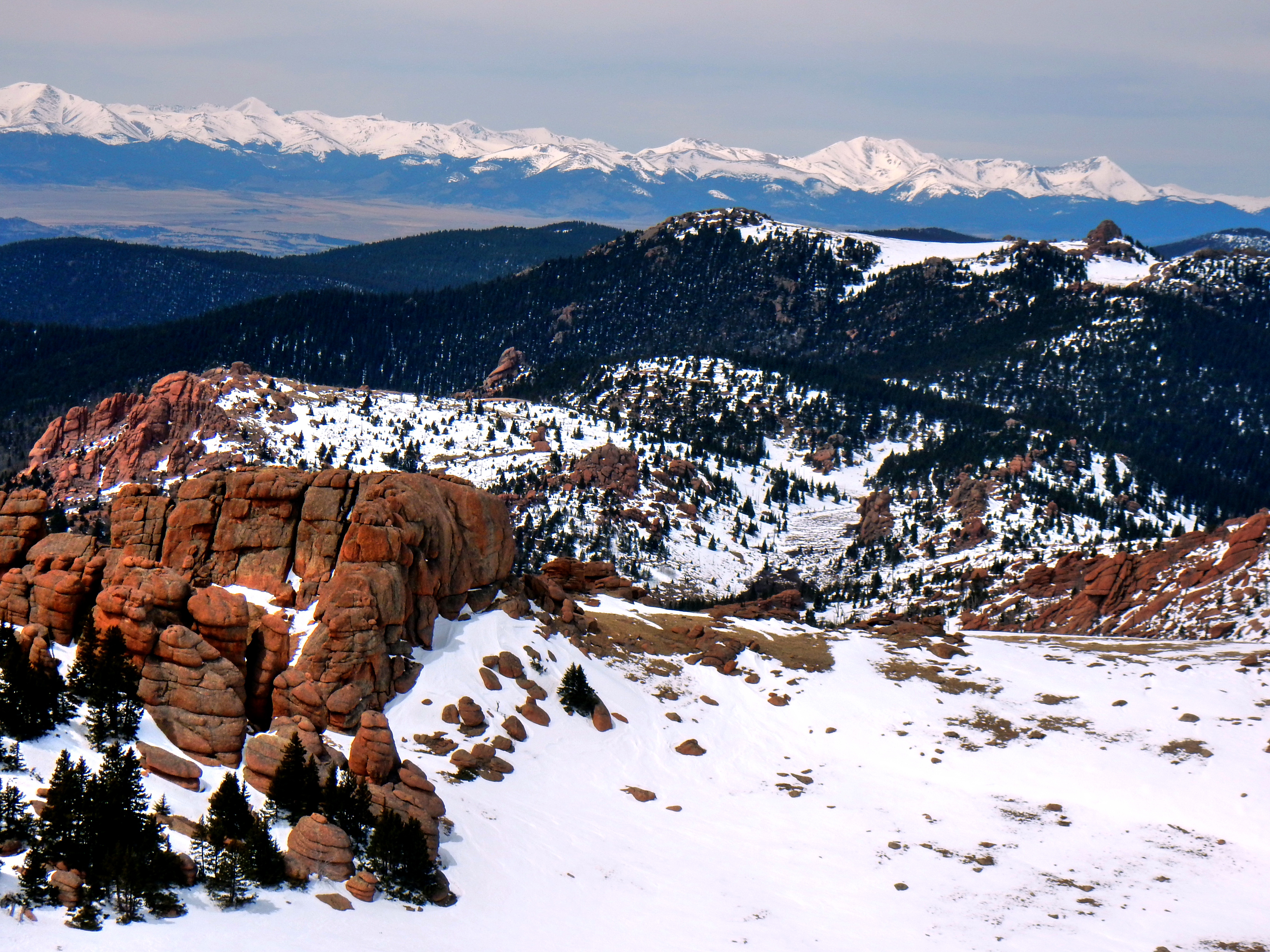
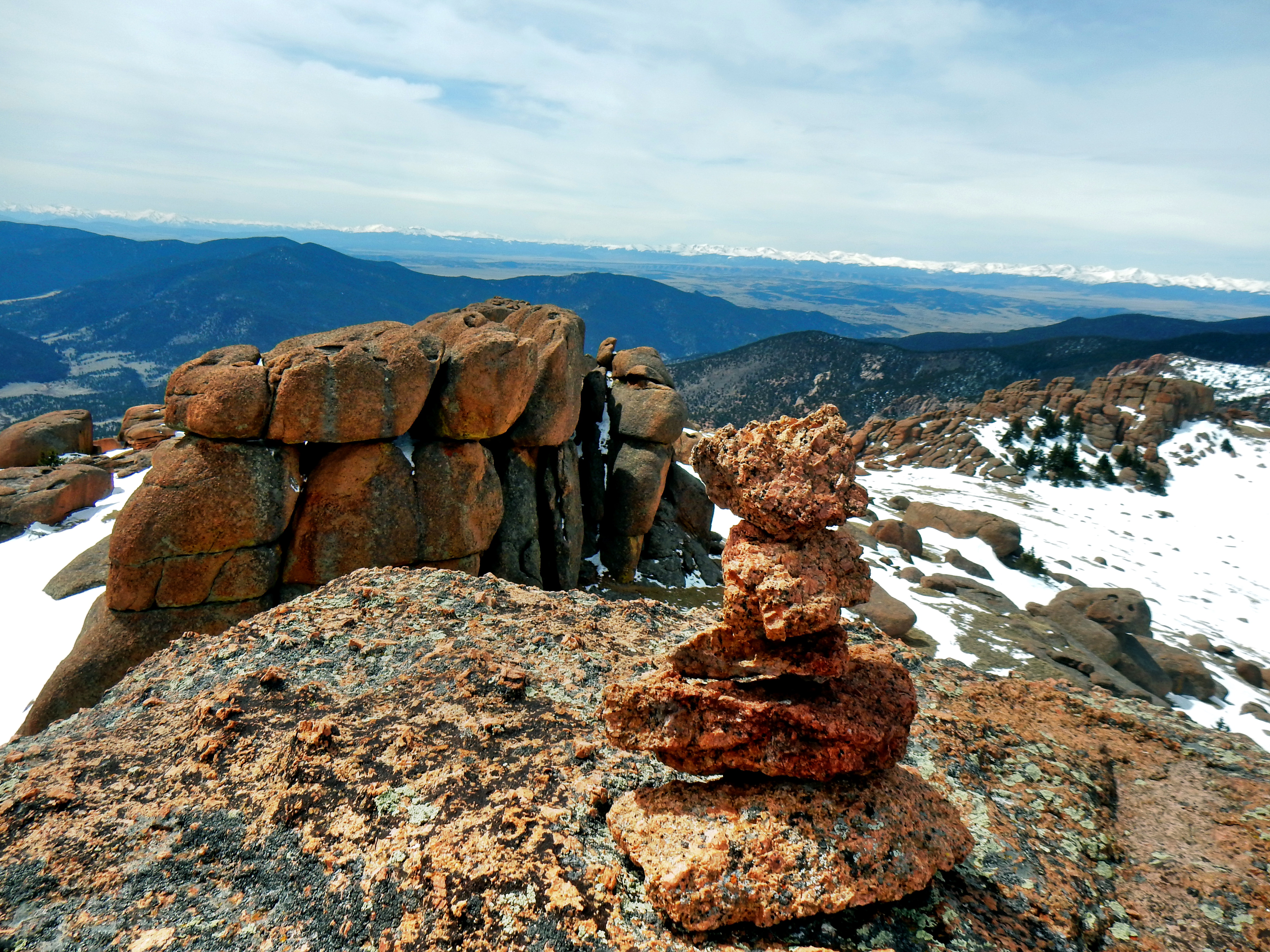
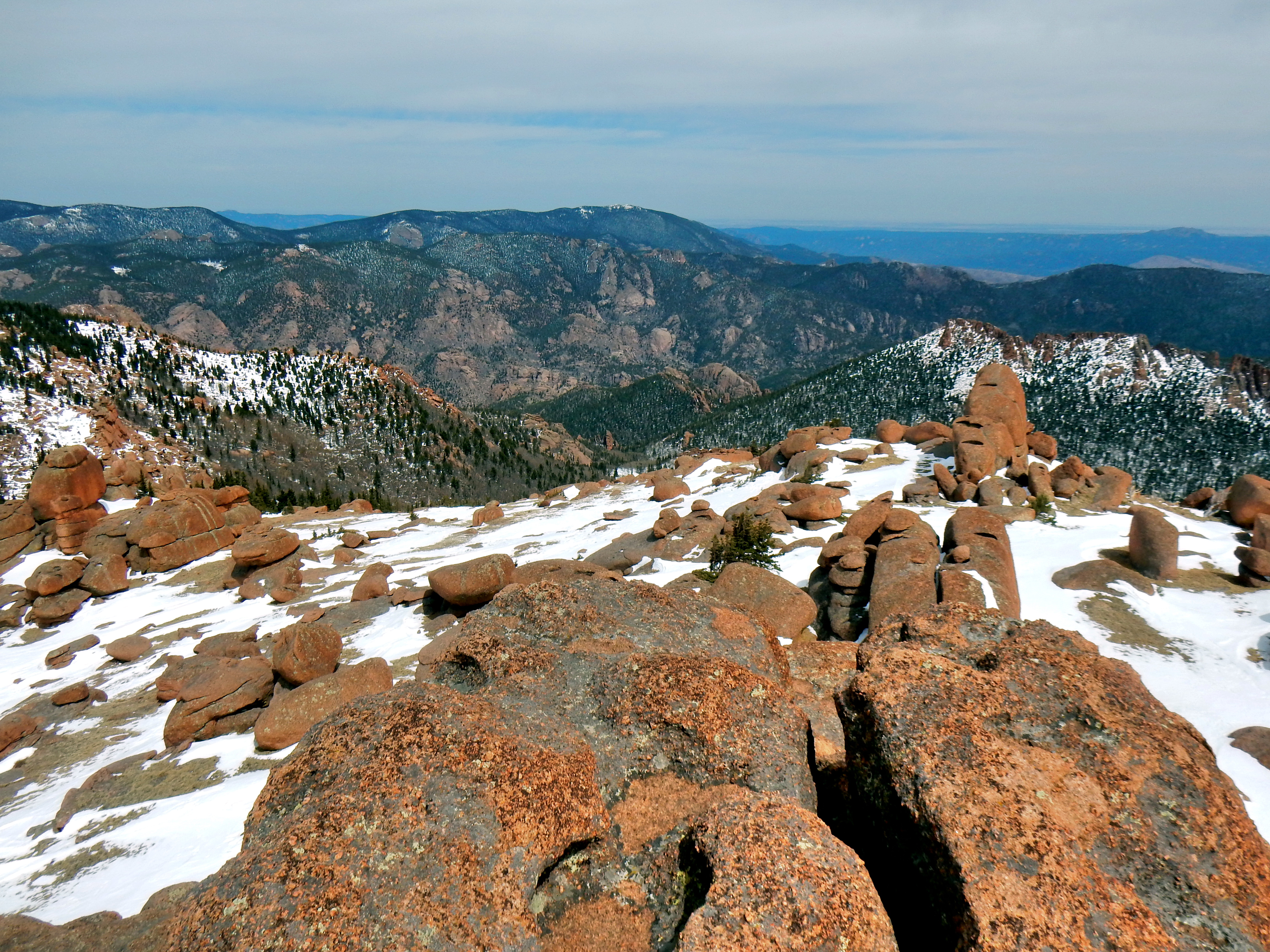
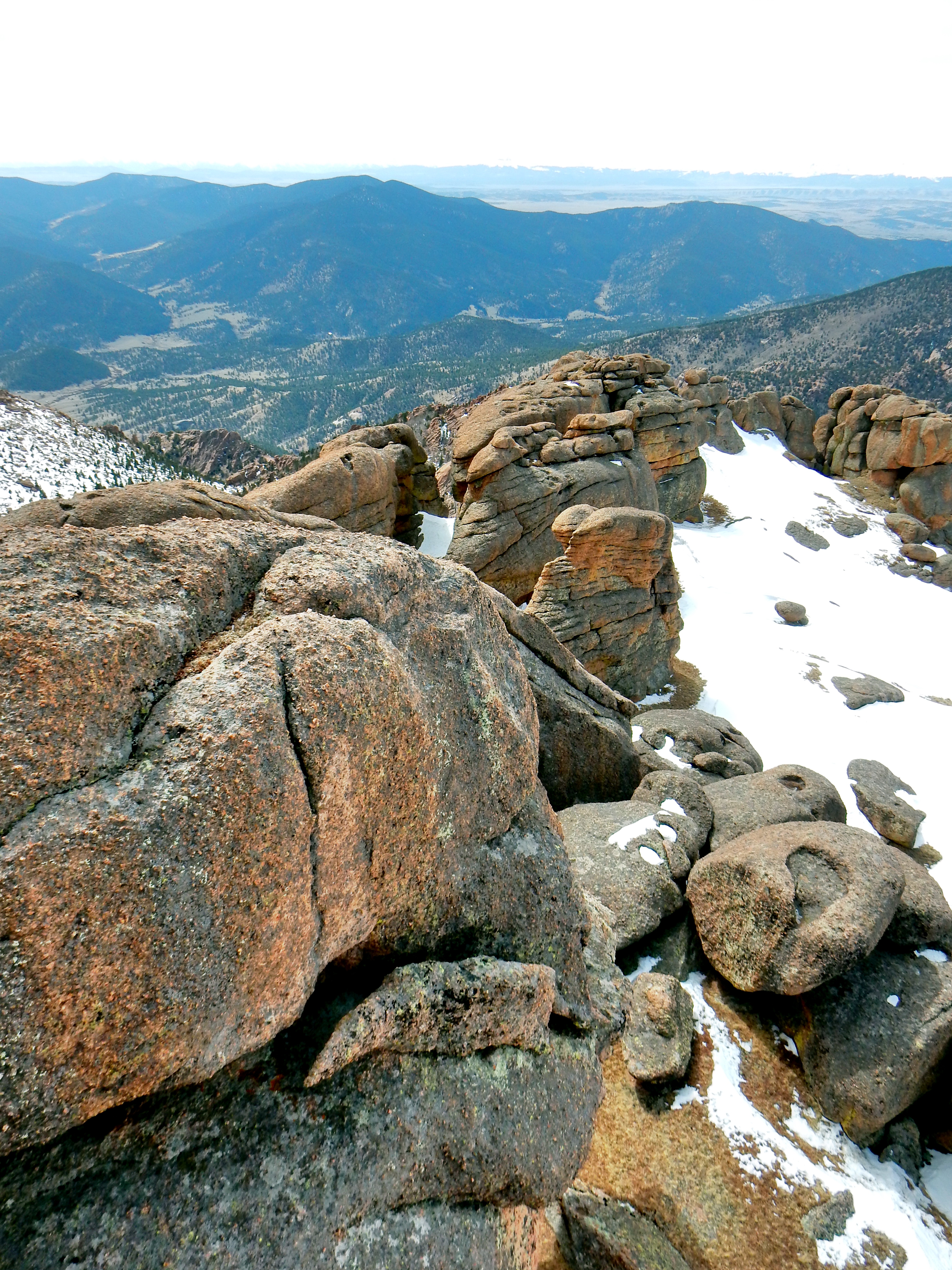
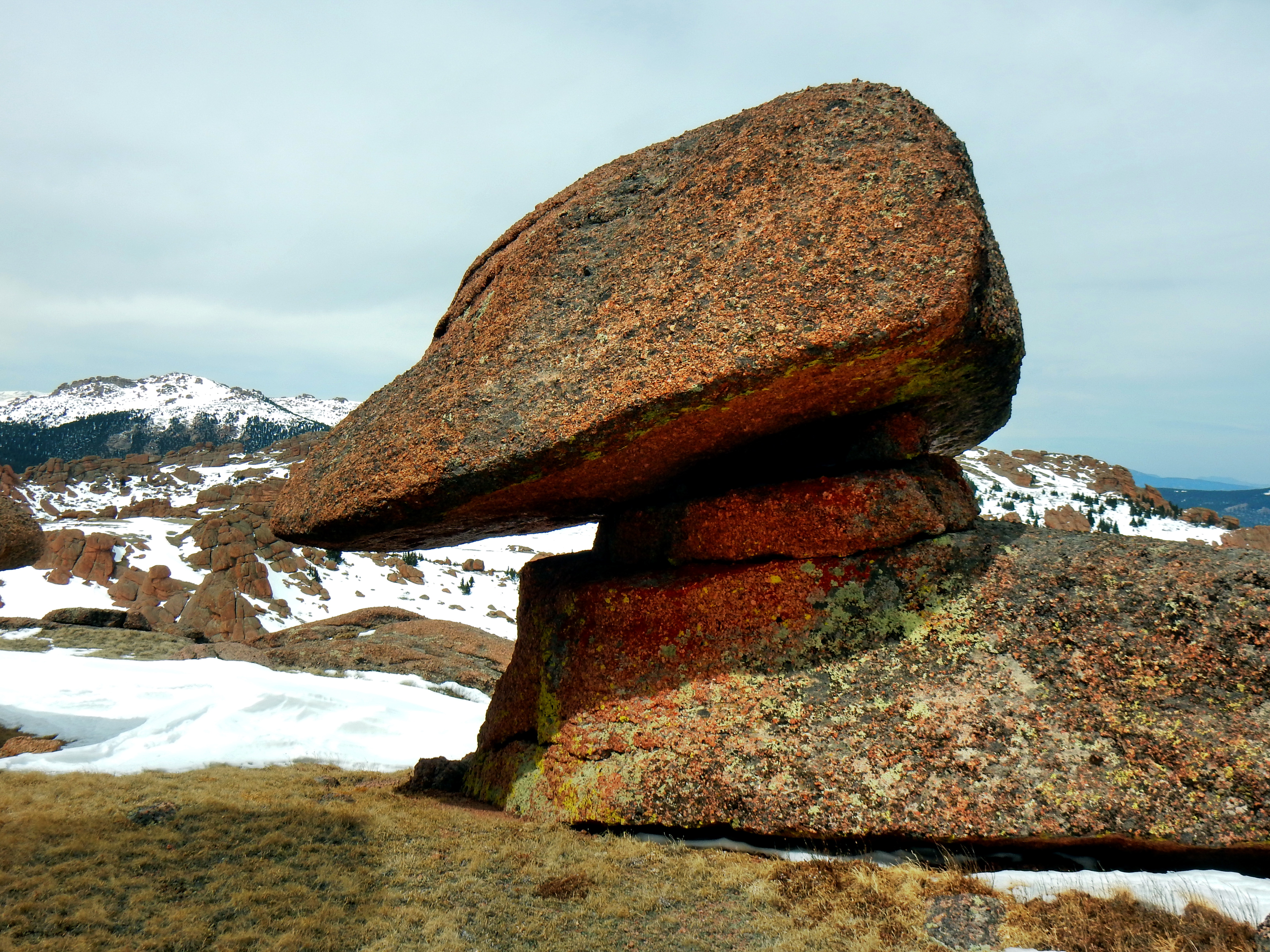
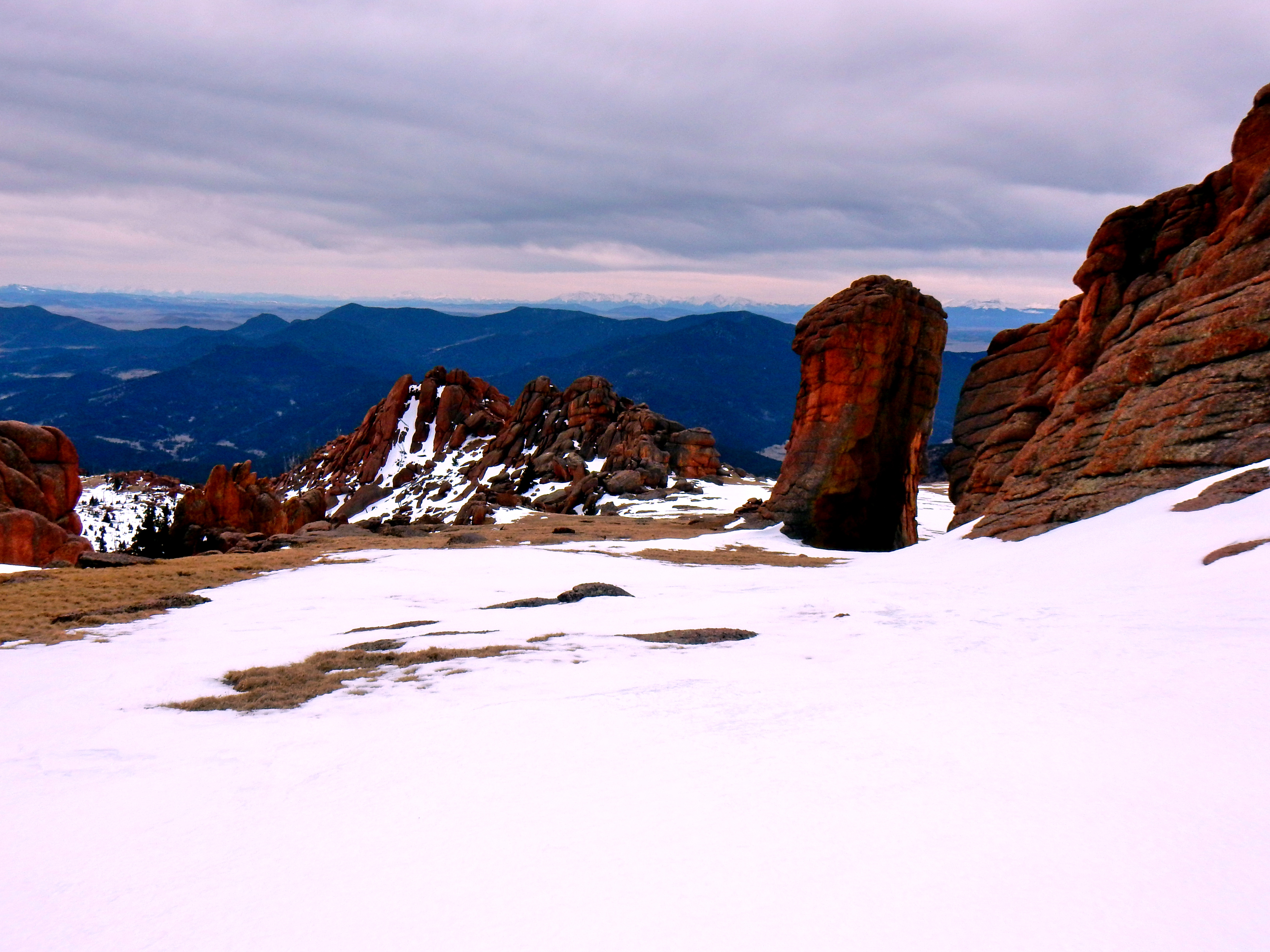
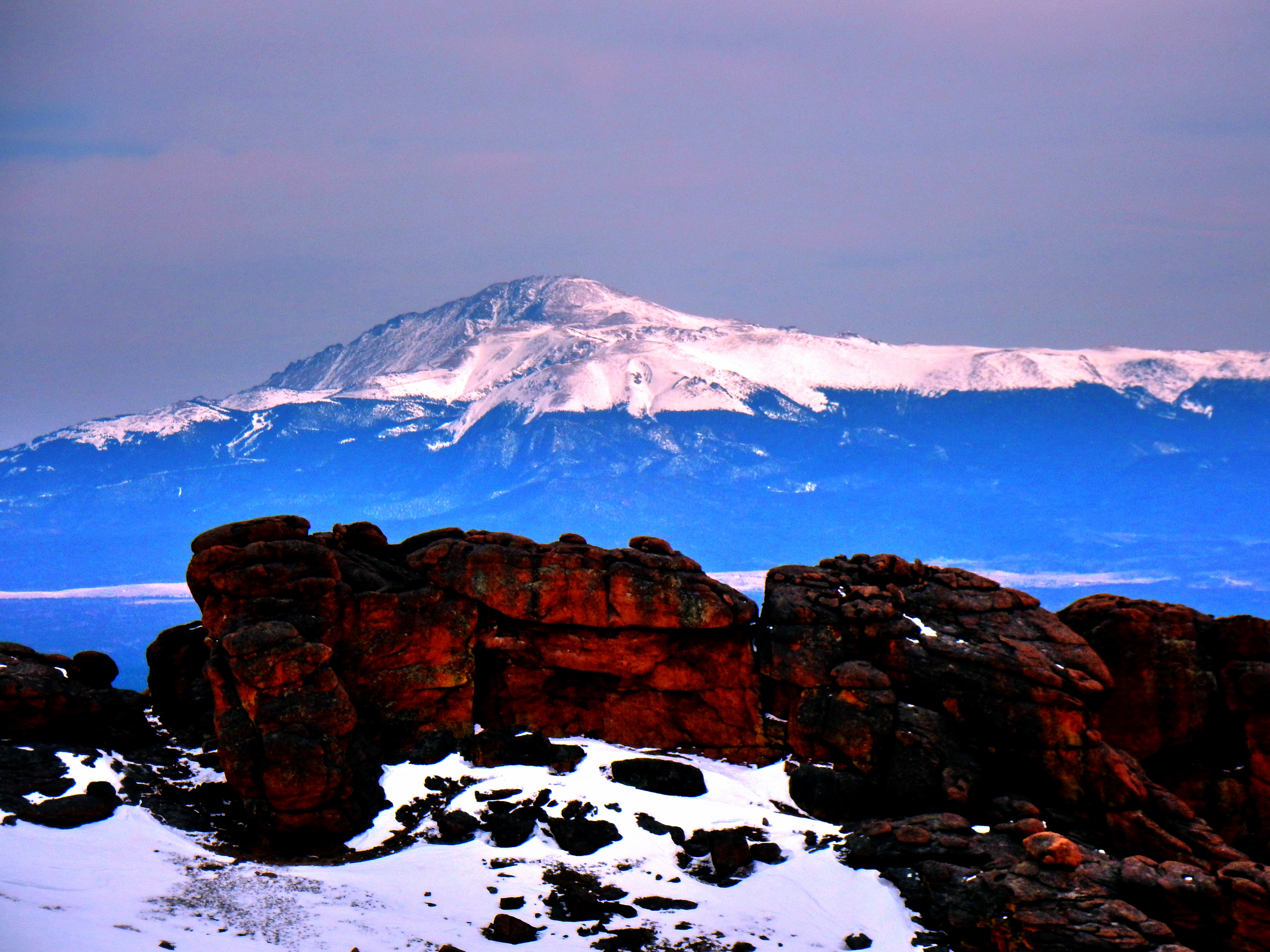
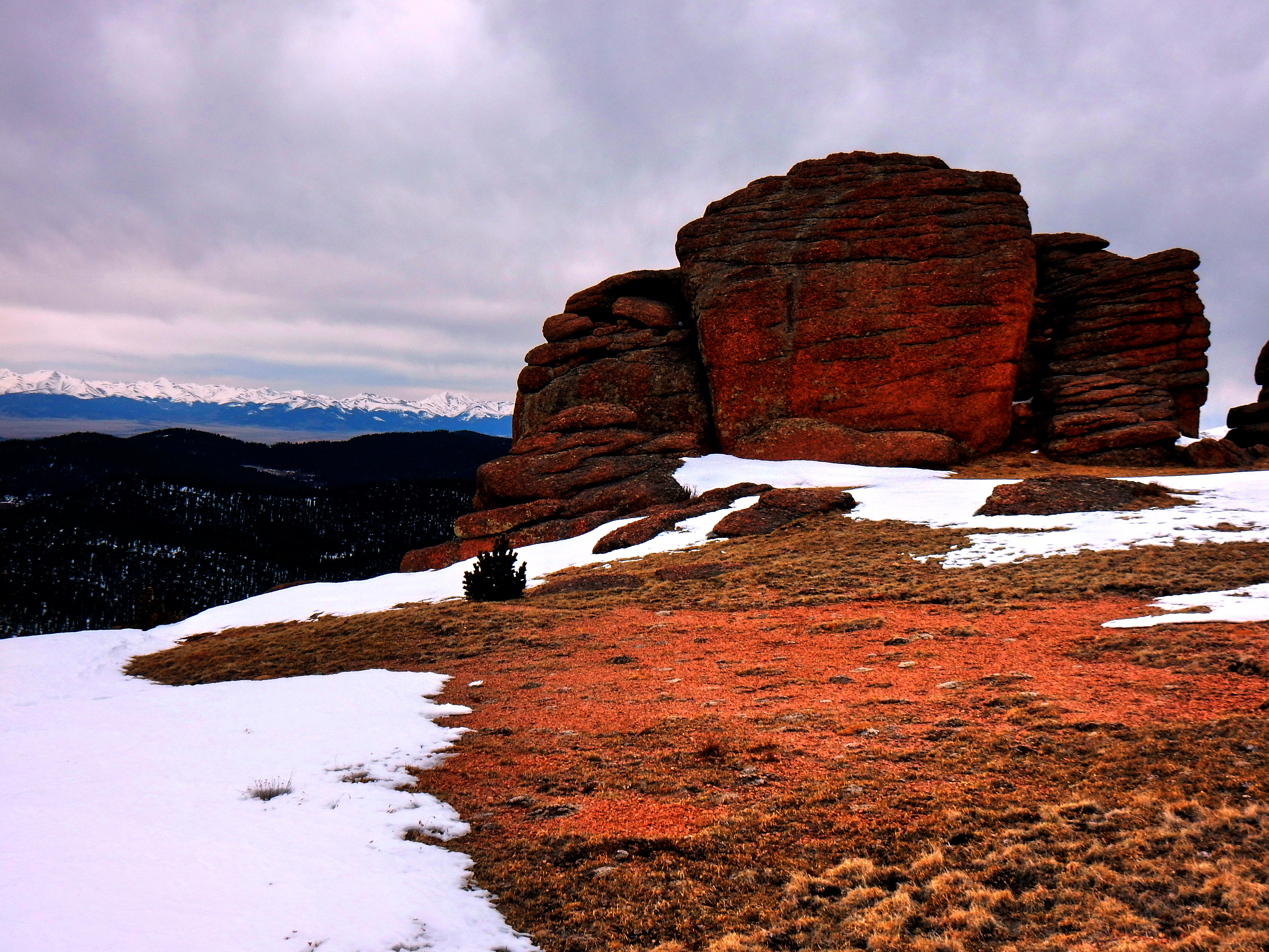
I periodically gazed back on my way up, but the view from the first wall was much better. The sea of rock creations in McCurdy Park were very impressive from my new vantage point. Also, Pike’s peeked over in the distance.
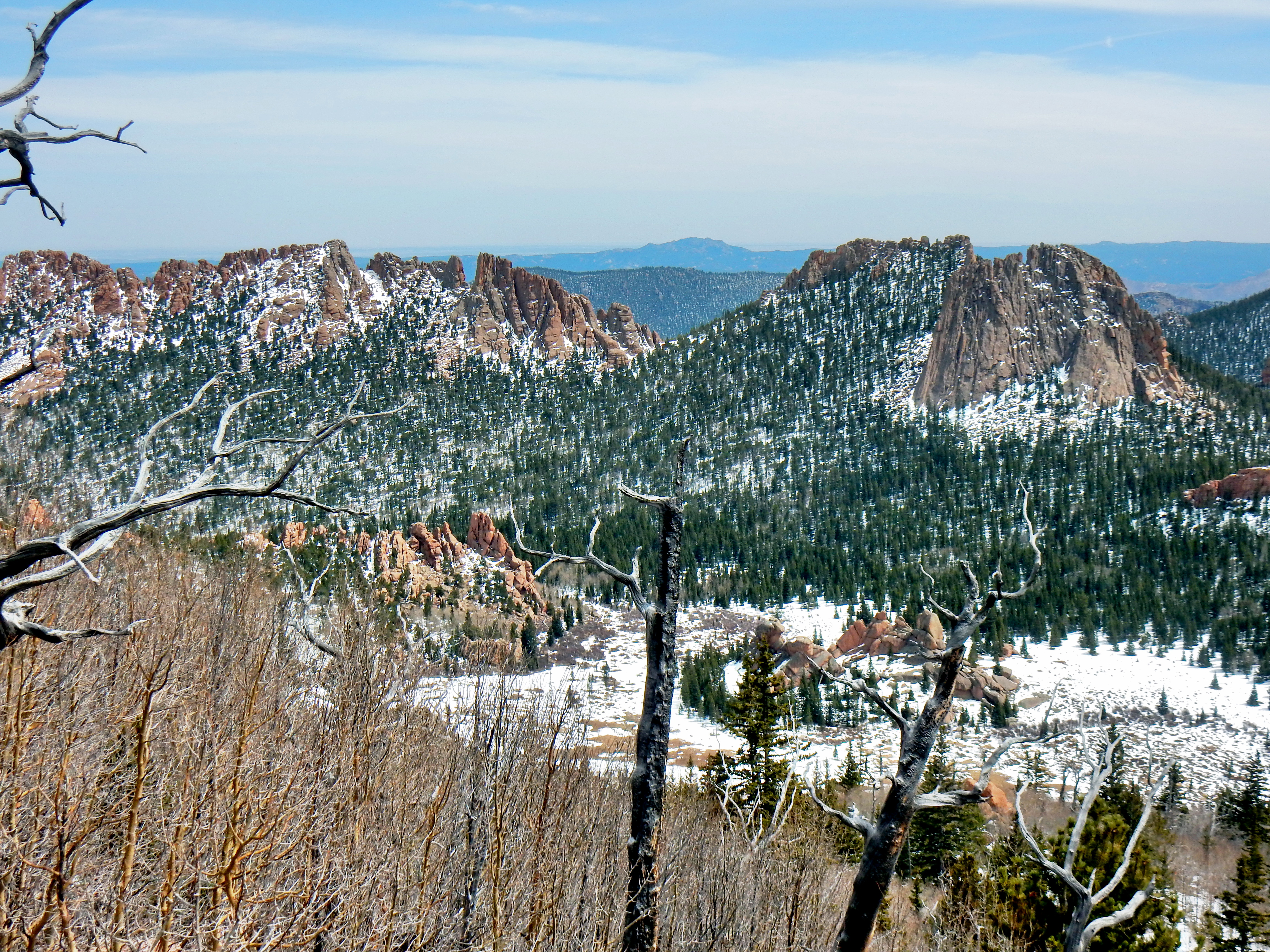
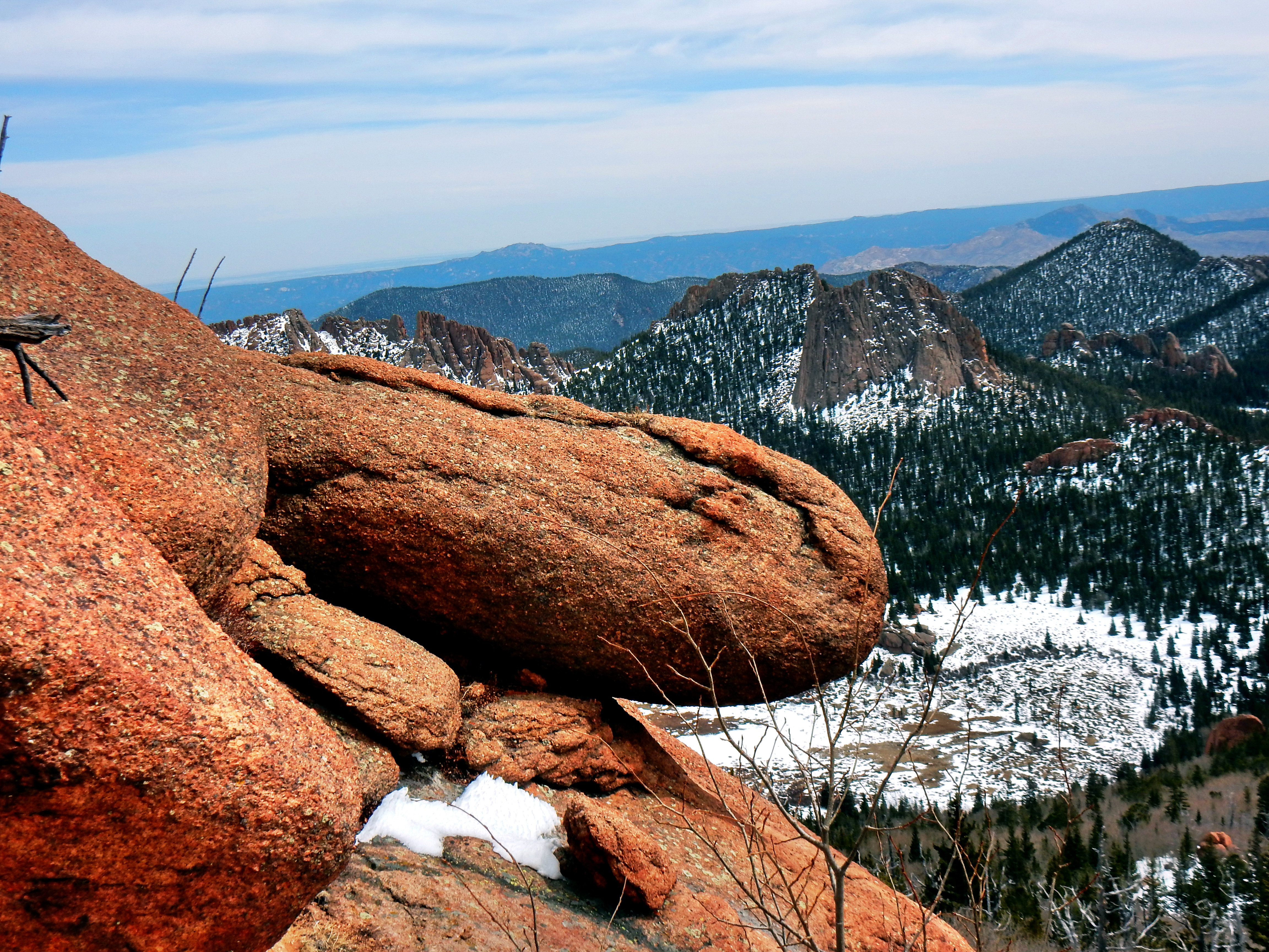
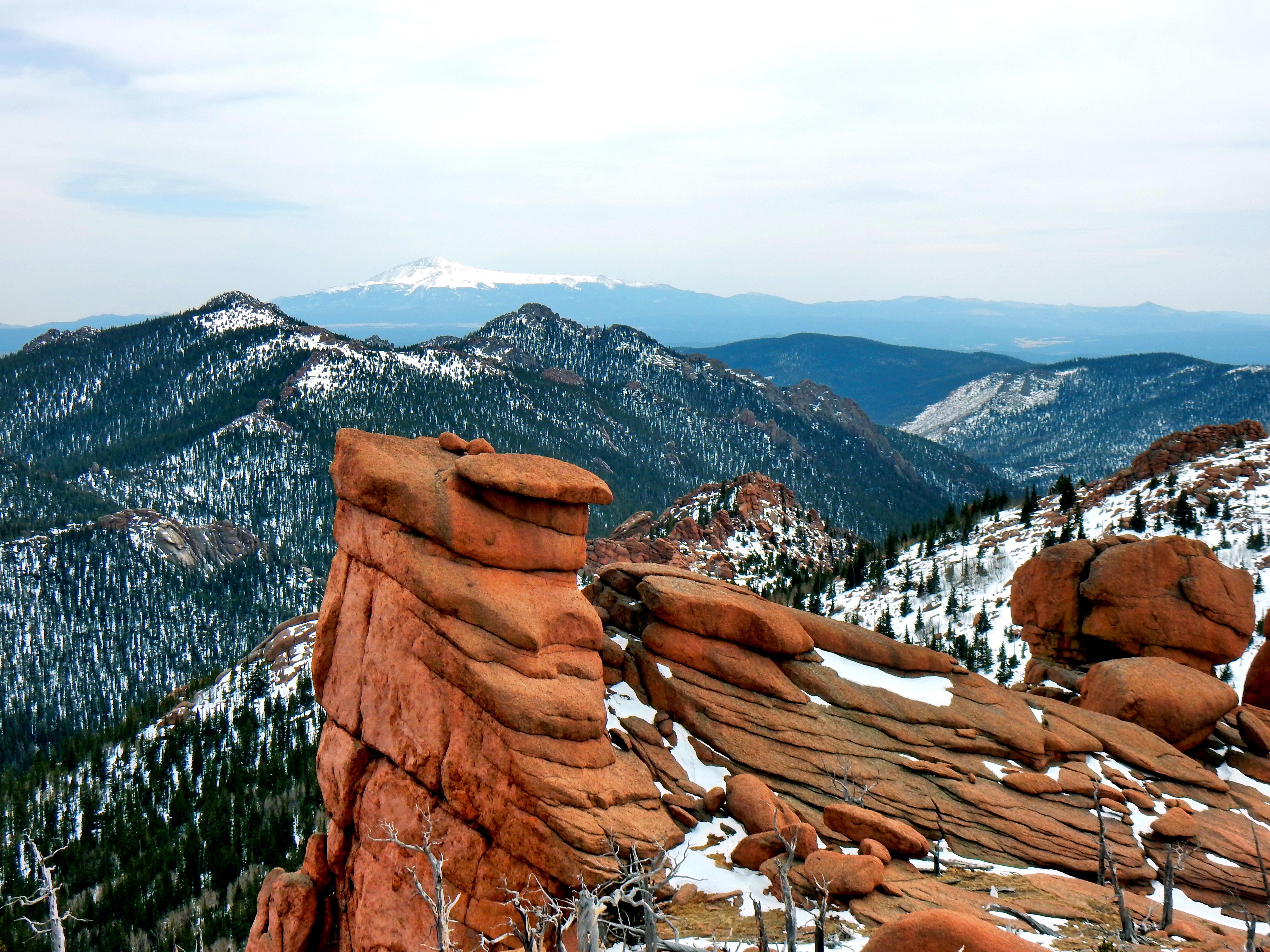
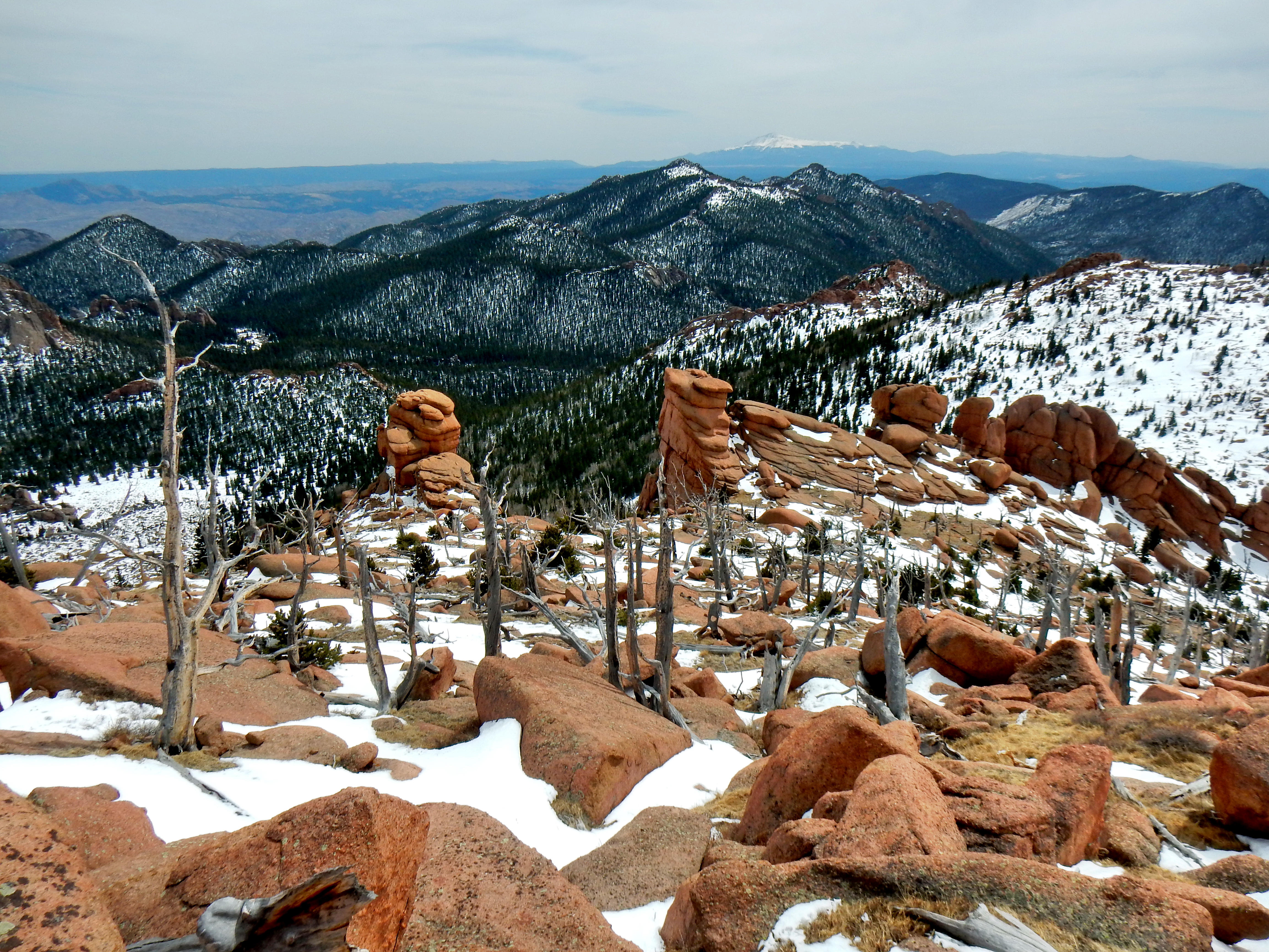
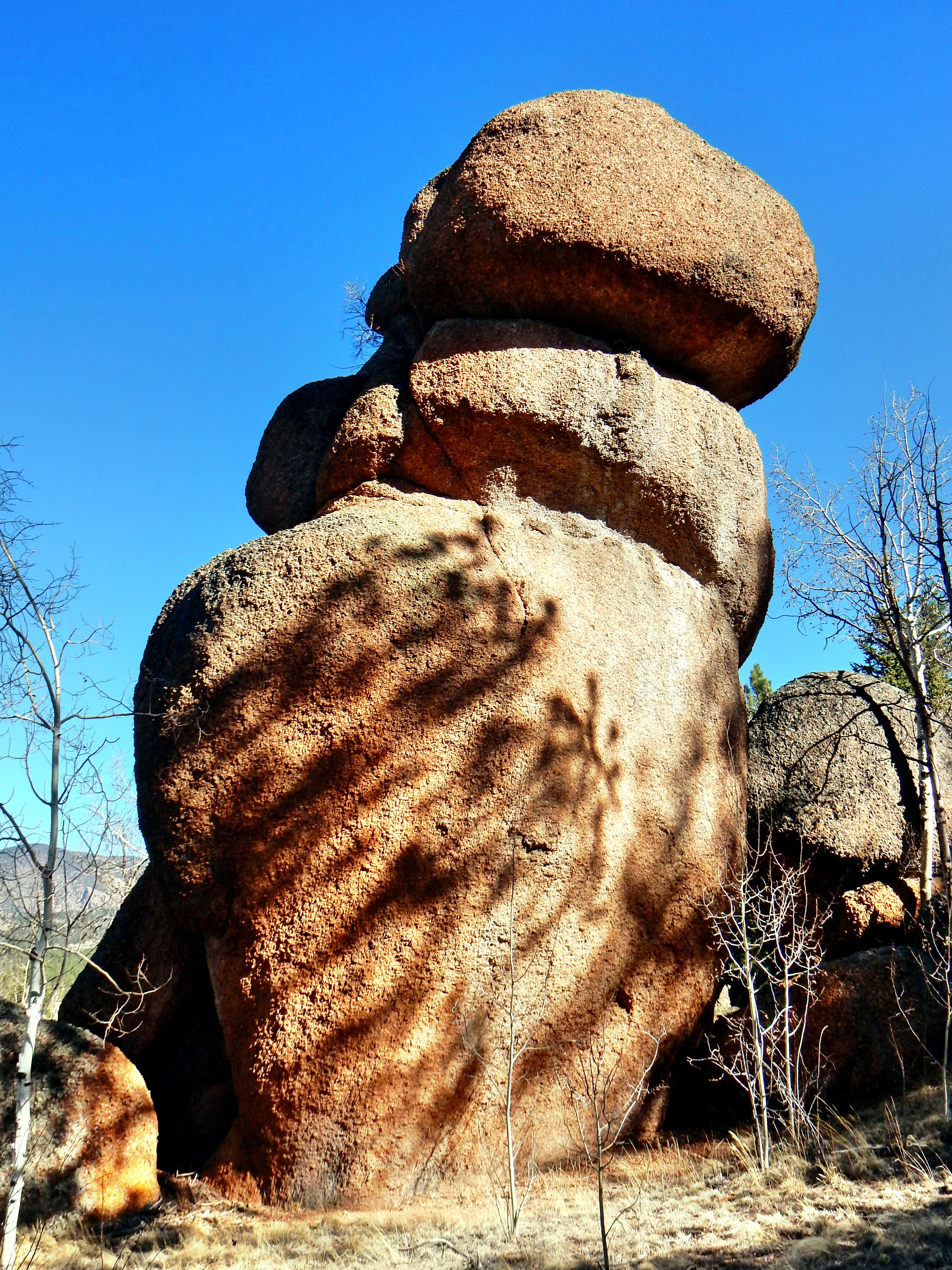
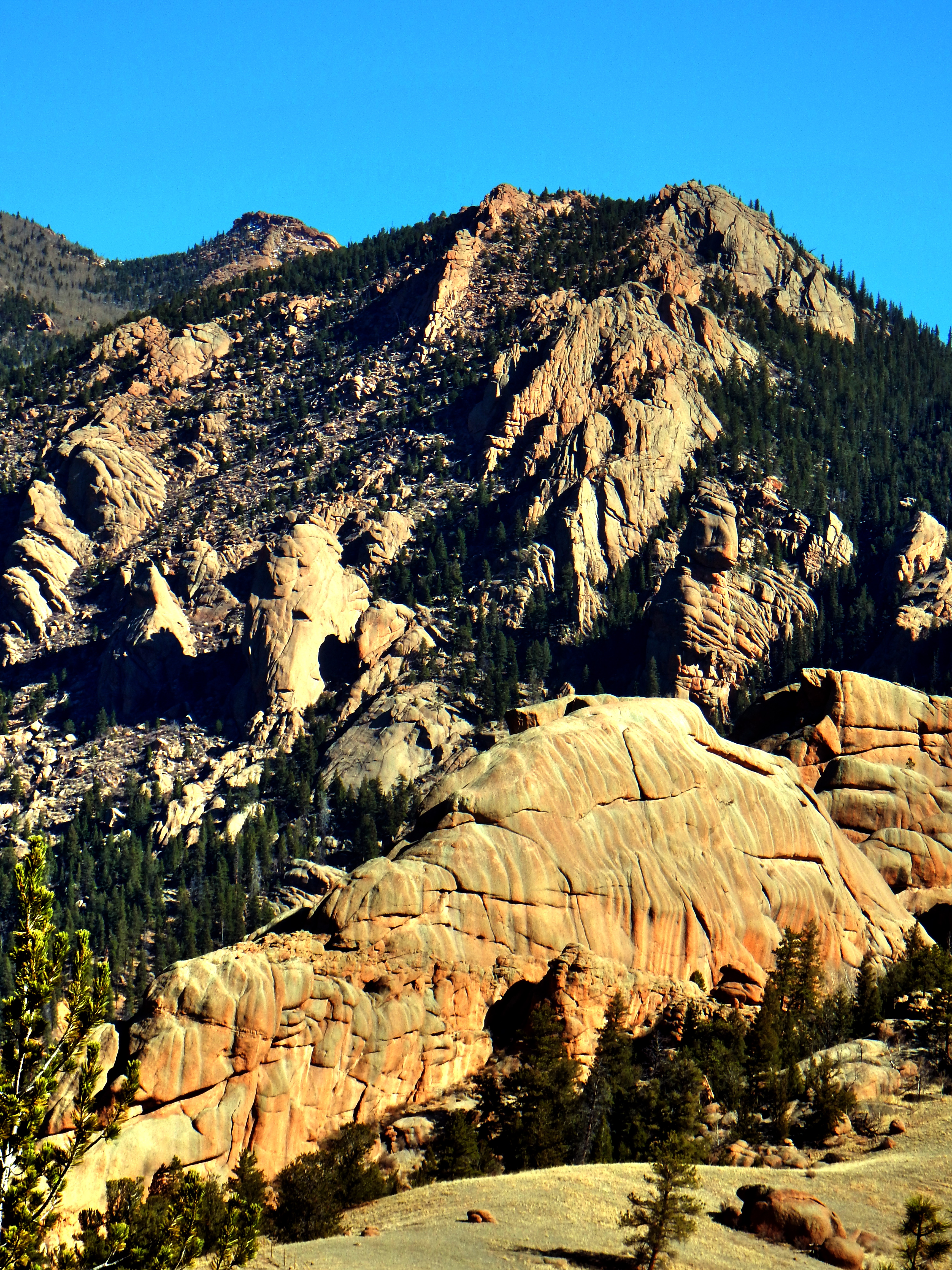
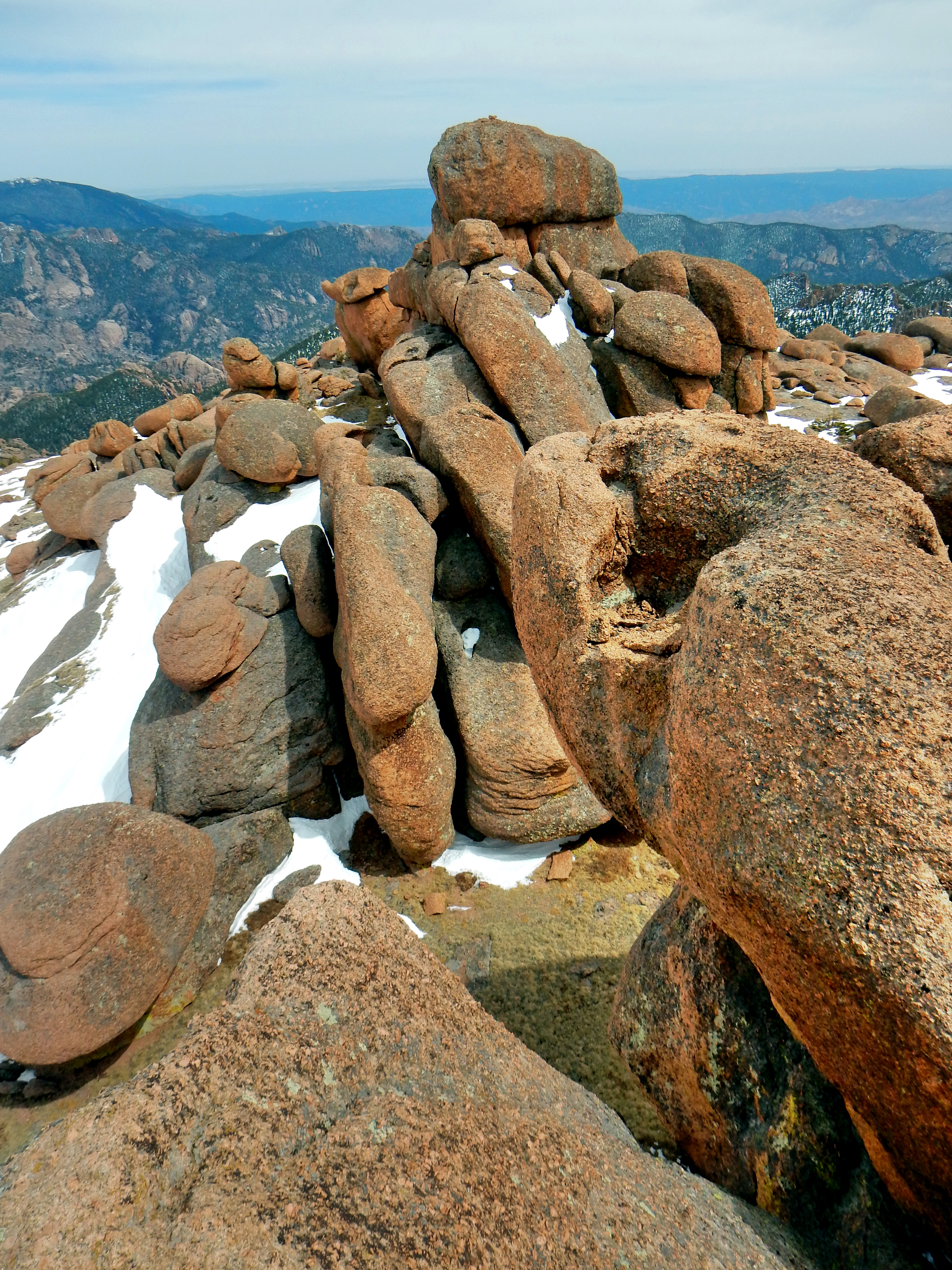
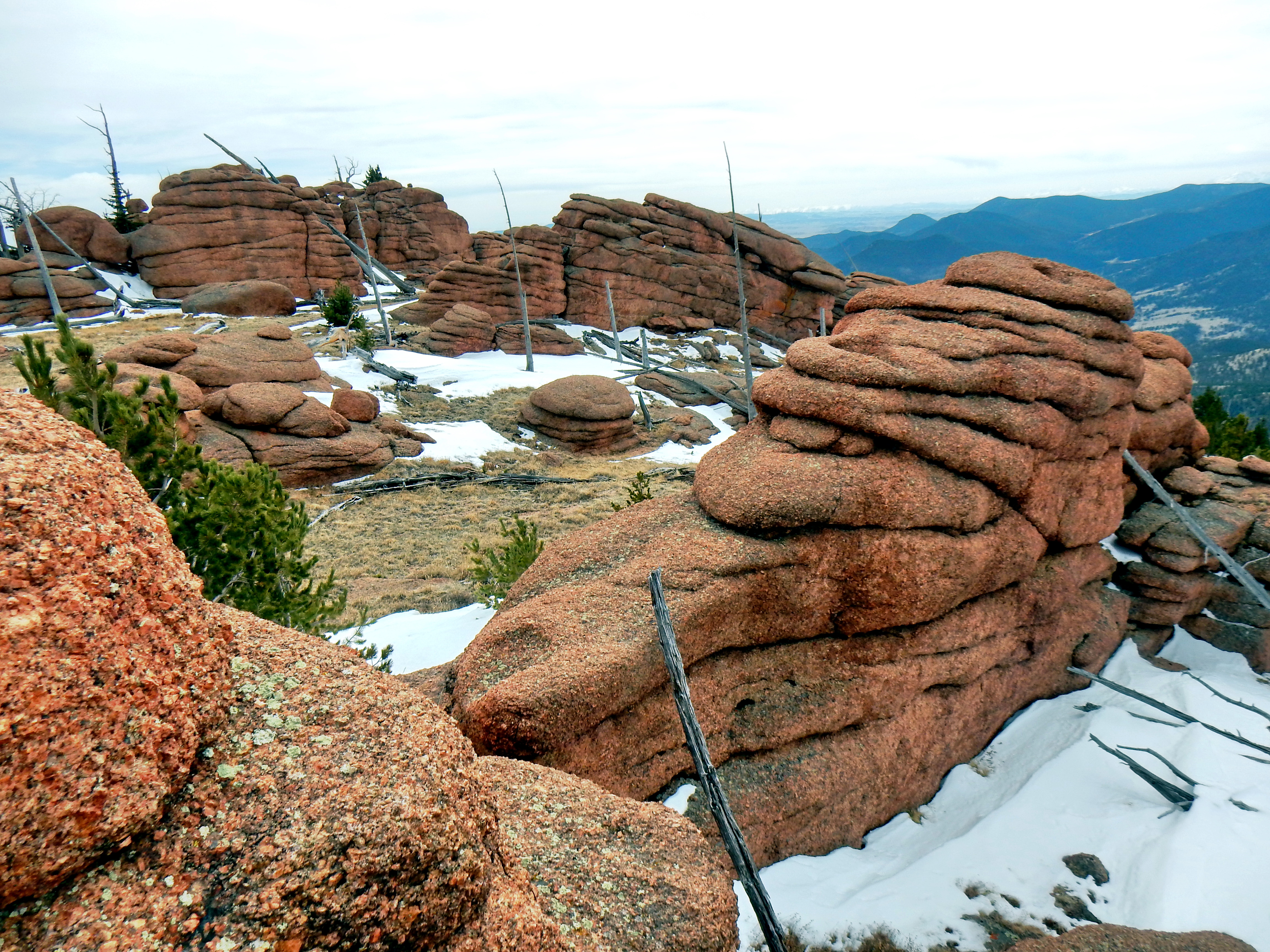
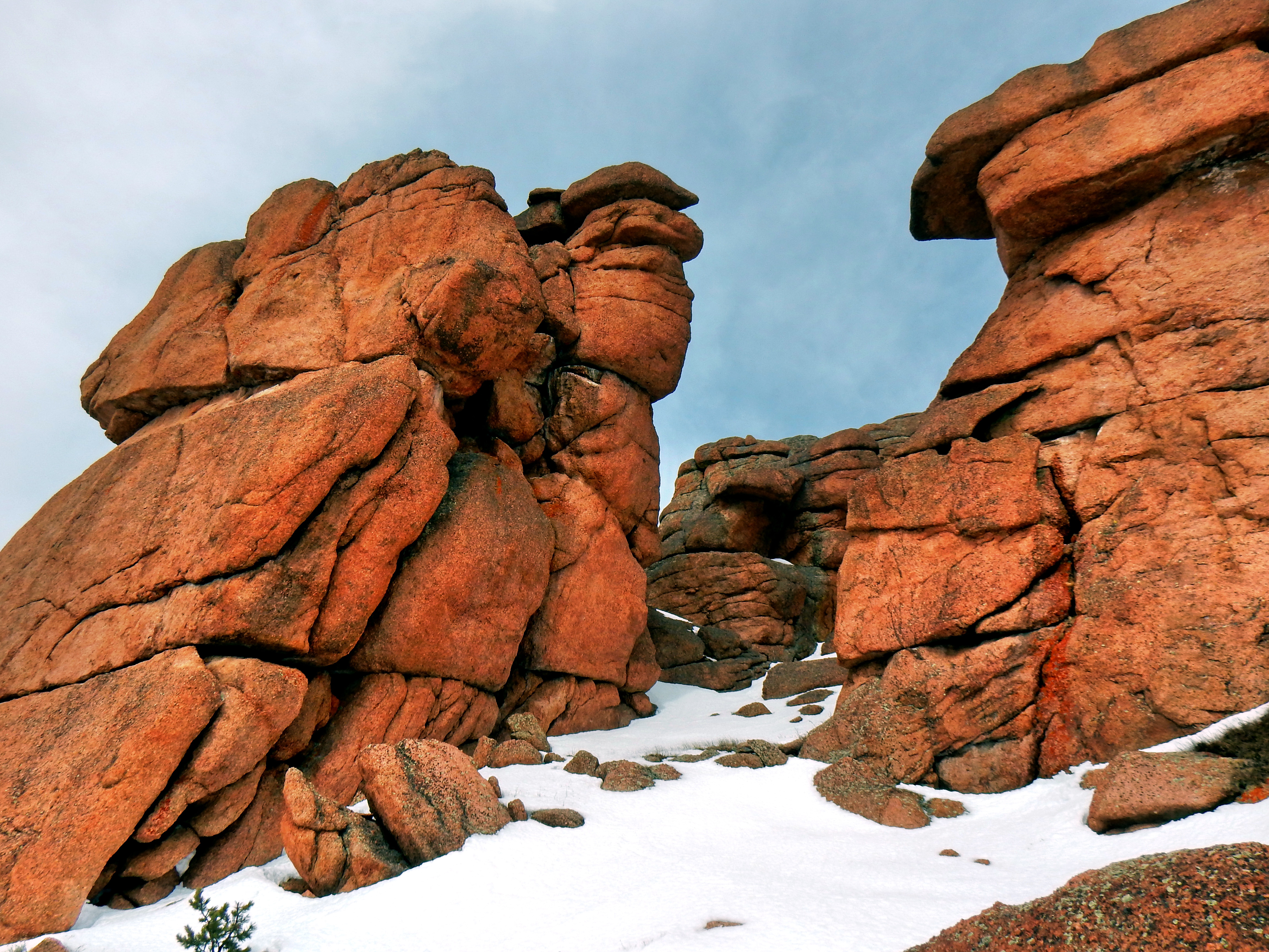
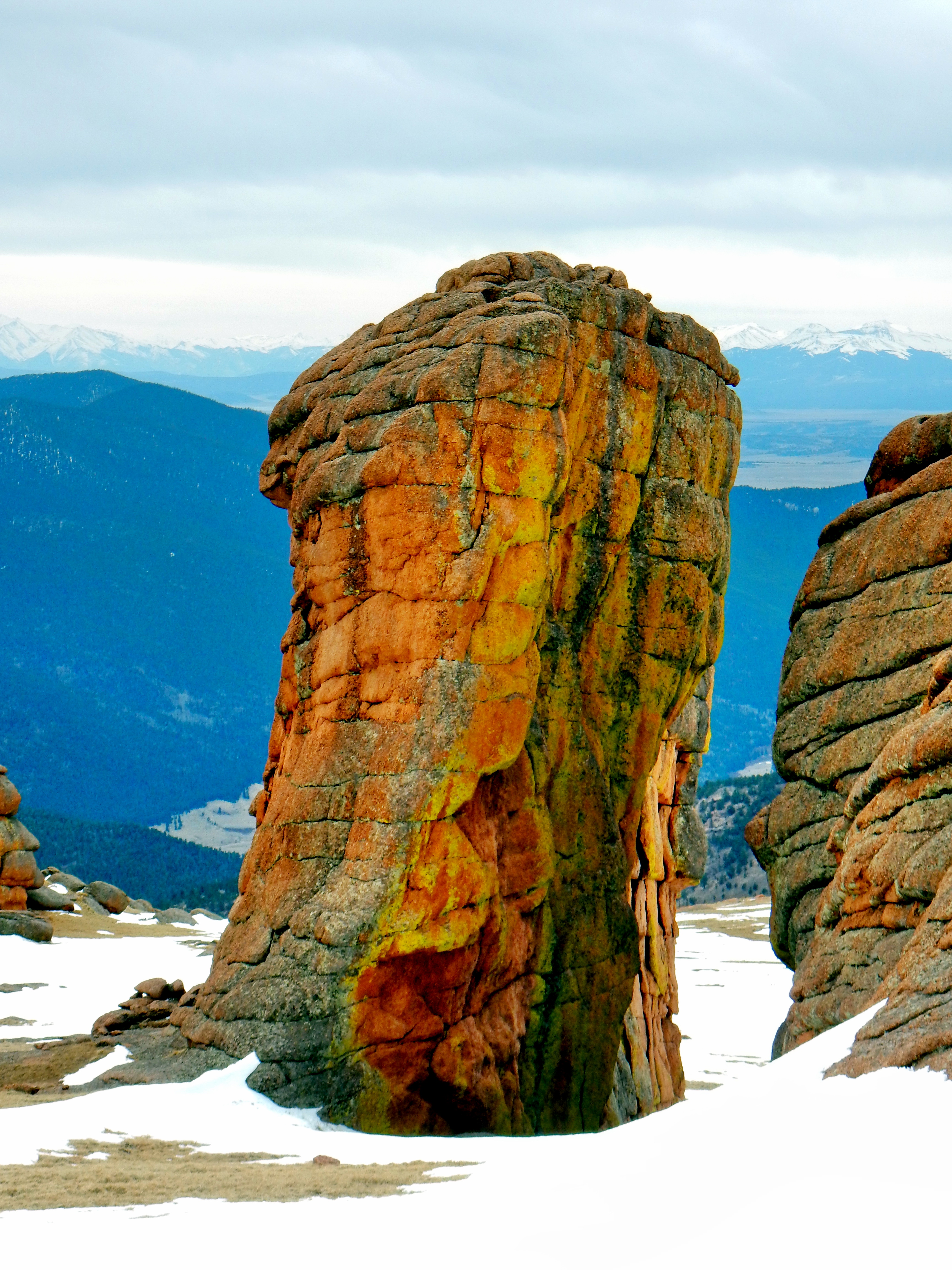
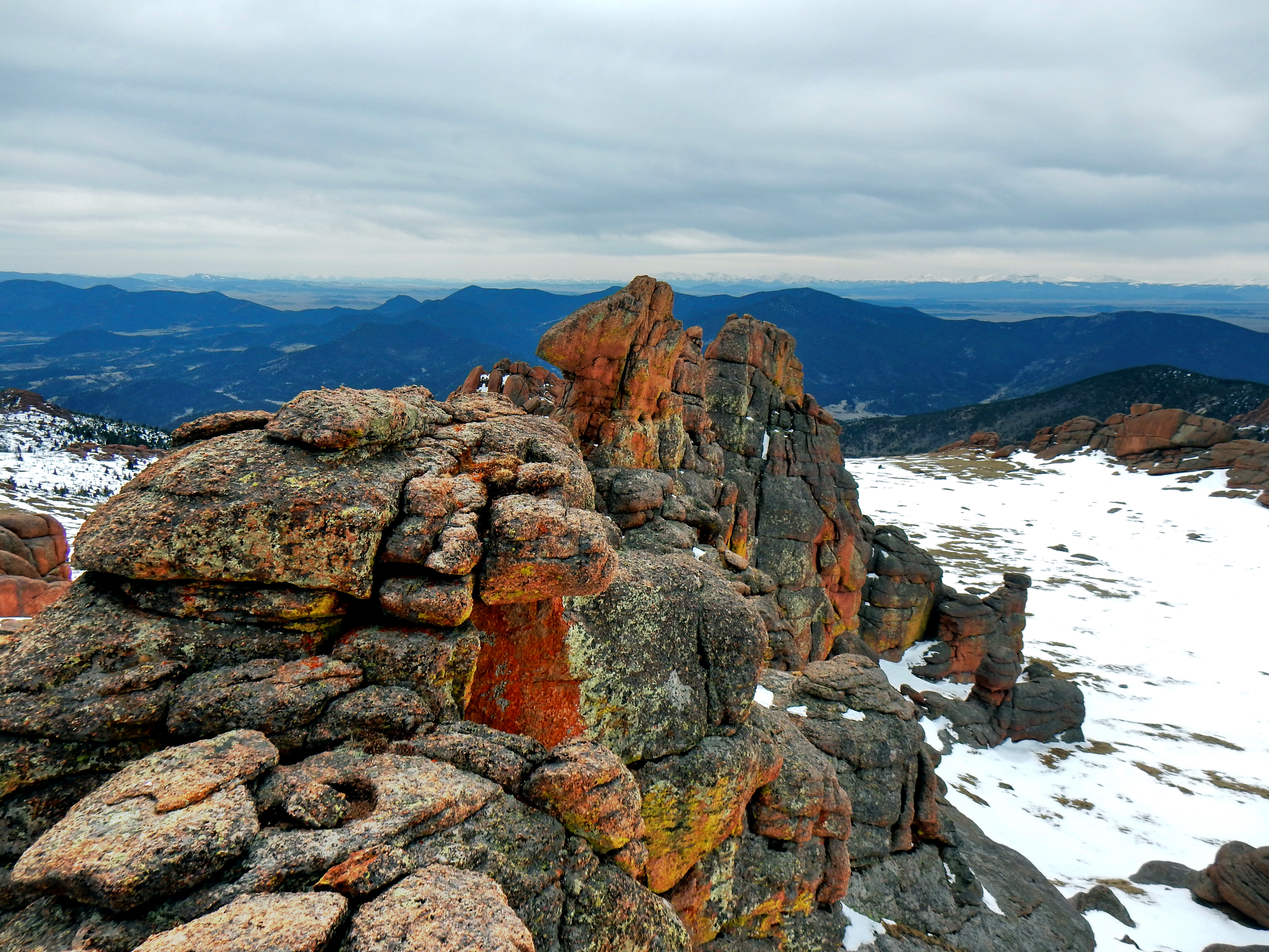
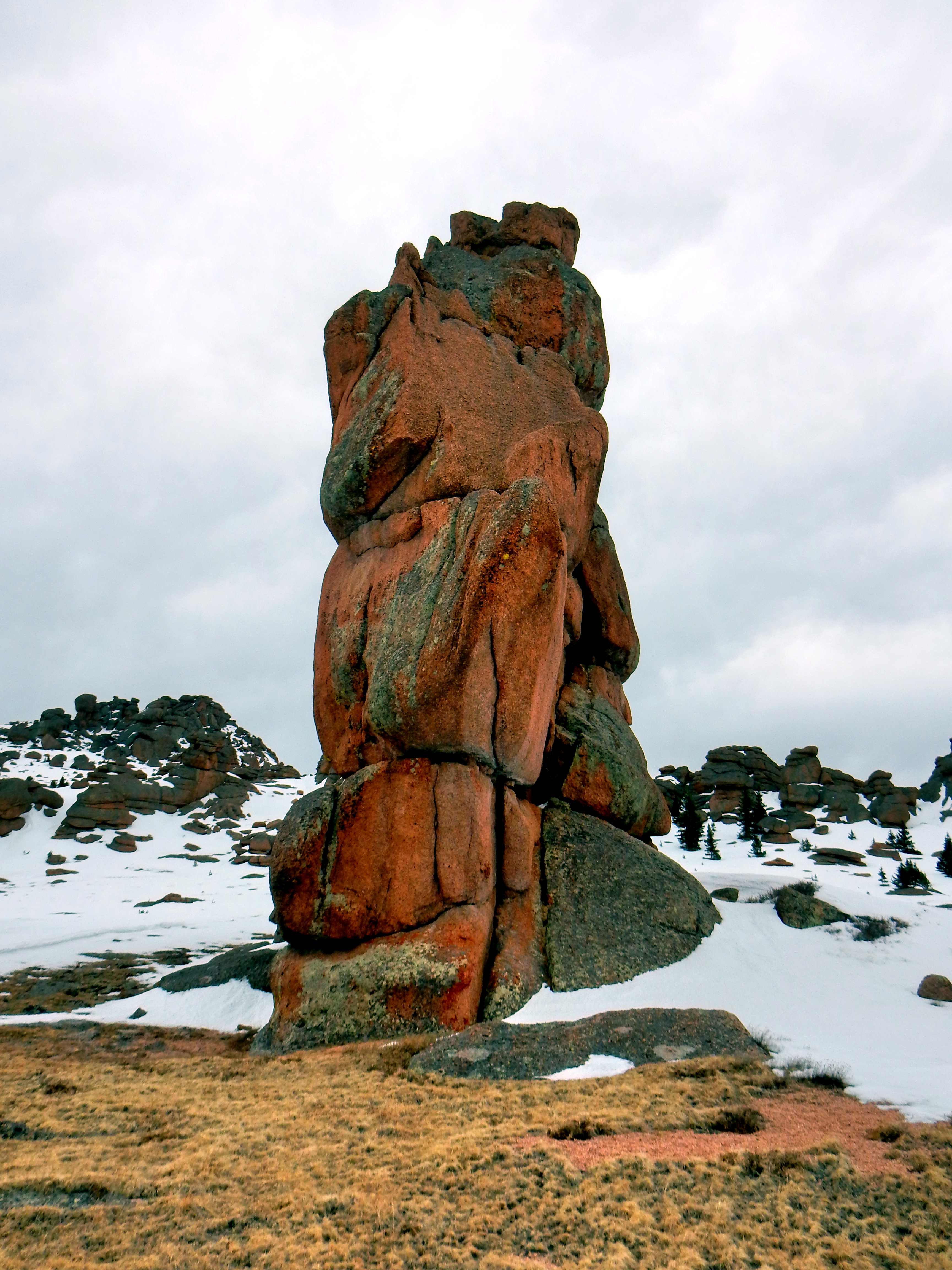
After arriving on McCurdy Mountain’s summit, I discovered how truly expansive it was! McCurdy Mountain is chock full of unique rock masses and towers. I was never quite sure which summit was the highest, so I ended up climbing a ton of them just to make sure I could comfortably say I had summited. I climbed up several towers that appeared to be the highest as I approached, but were very clearly not as I reached the top. The problem was that the formations were large enough that I was unable to tell until I climbed up a few of them. I had read on SummitPost that the north summit across the bowl was a little bit higher, but for some reason I still climbed up several points on the south summit. The south summit looked higher while I was on it and I spotted a cairn atop two of the highest towers as well. Climbing up each stack was a lot of fun and I got a little carried away perhaps. I can say with certainty that I reached the highest point on McCurdy Mountain! ***A few of the boulders require a few Class 4 moves, but most are attainable by using ramp cuts or connecting a series of rock hops***
Well, my day was just getting started as it turned out, but before disintegrating into the madness; here are a bunch of summit shots from the south and north summits!
Alright, hope you enjoyed the summit shots! It was only about 2pm when I reached the summit, but I was really tired. Many of my climbing muscles were just coming out of hibernation too. I had a rough backup plan the entire day of heading over toward Bison Peak and heading down the more familiar Ute Creek Trail depending on conditions. I knew the bottom of Ute Creek trail was about 3 miles on County Road 77 from the Twin Eagles trailhead, but I had no desire to return to the extensive post-holing and bushwacking from the way up. However, the approach on Ute Creek wasn’t quite as long either, so I was thinking it would even out. Plus, I spotted Bison Tower (not sure if that is an official name) across the way and it didn’t look to far away.
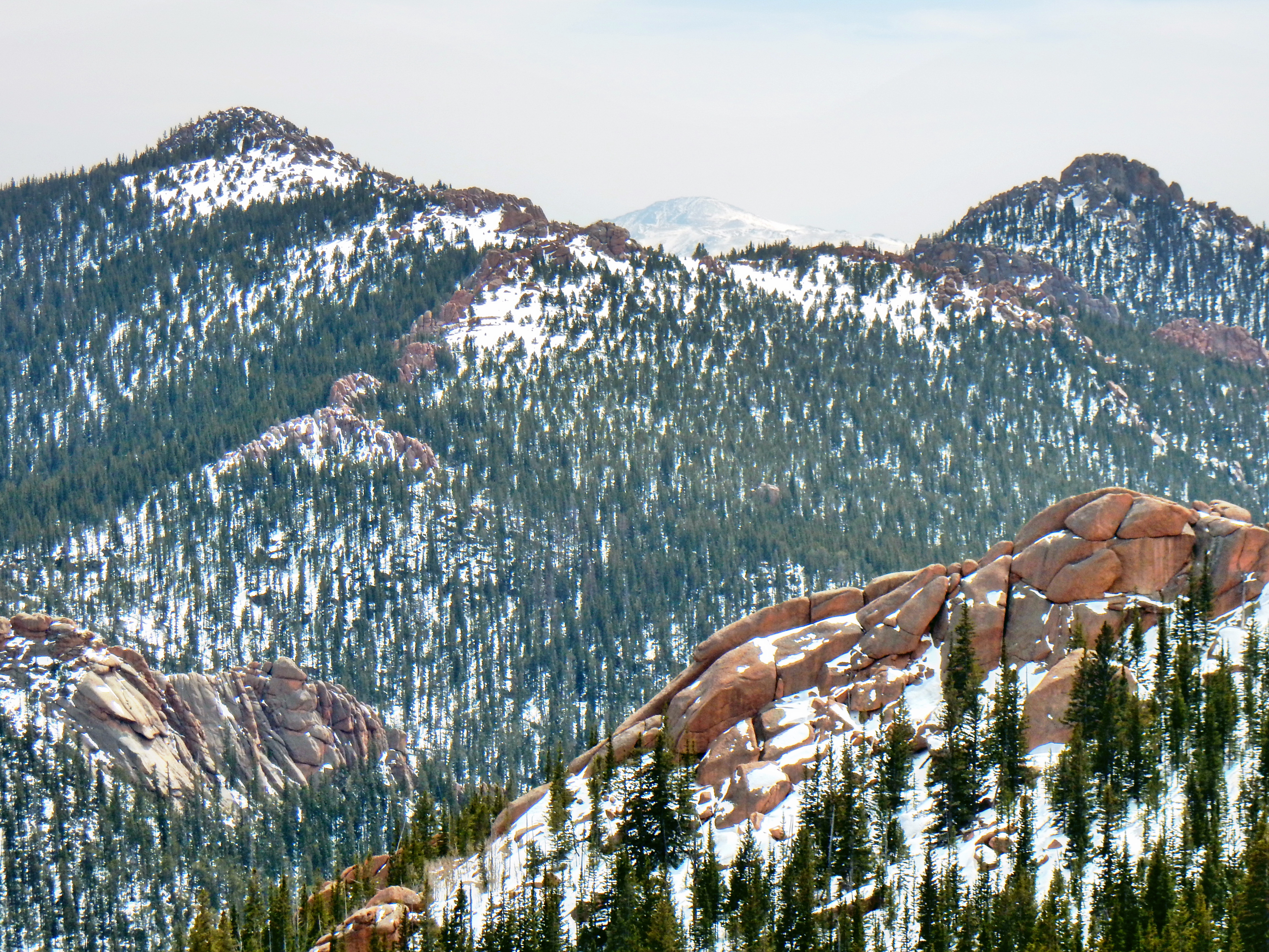
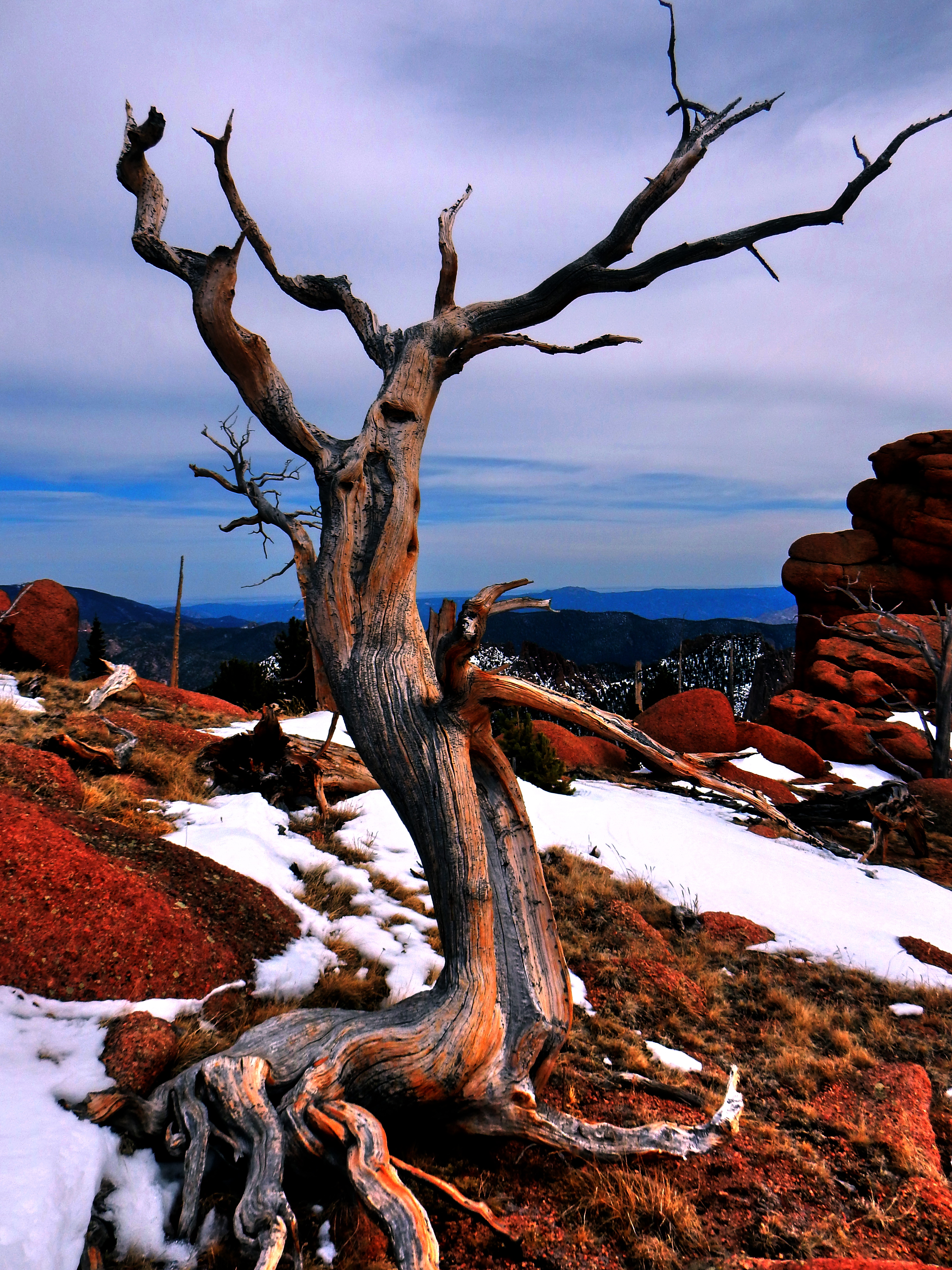
I don’t know that heading for the Ute Creek route back down was a bad decision overall, but I made a truly awful decision somewhere in the middle of the forest shortly after leaving the Toaster. There was a lot more snow than I expected and before I knew it, I was sort of lost. The smart thing would have been to backtrack to the last known point, but I was tired and didn’t want to climb back up. It was really stupid, but I just kept going and thought I familiar enough with the route that I could just freestyle it. Well, the Lost Creek Wilderness provided yet another humbling experience and I’m not sure I’ll be back in the winter or when snow is still present any time soon. The area is just so unforgiving and expansive if you get off course. Plus, my navigation skills are obviously terrible in dense forests.
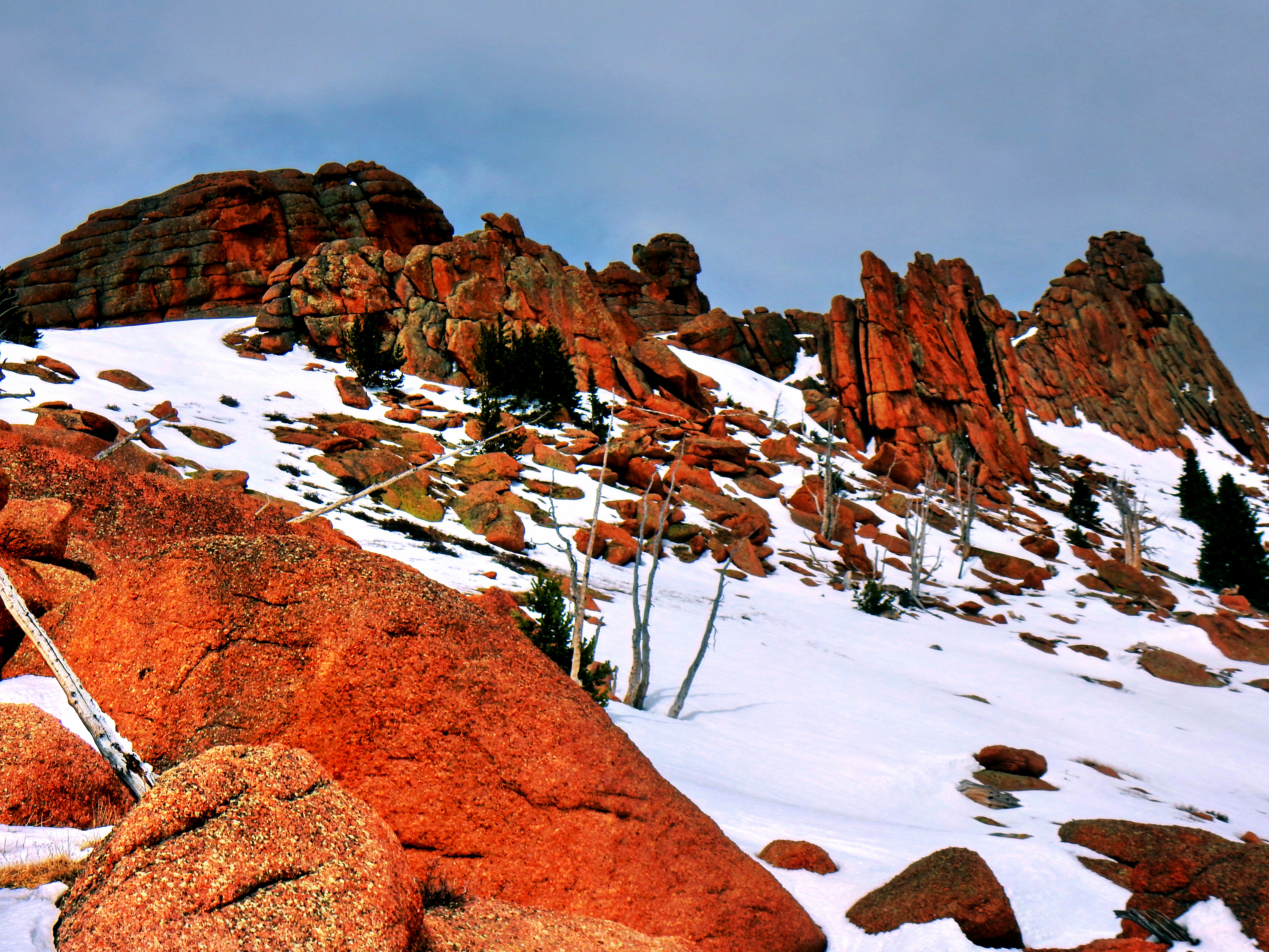
I never panicked and was a little too cavalier about getting several miles off course. The final several hours of the day toed the line between fun adventure and misery. Sometimes it is easy to forget how closely aligned the two really are. As I gazed up at the dramatic red faces across the way, I saw the sun creeping slowly downward. At that point, I felt like maybe I had lost my mind since I was so casual about the last several hours. It was time to get serious. Put your camera away! You’re an idiot and this could be dangerous…just get off the damn mountain!
Even after I put my camera area, I remained really calm and was still enjoying the day overall. I was exhausted and felt somewhat beaten up, but I’ve always taken a certain masochistic pleasure in that I suppose. In retrospect, I packed my backpack almost preparing for the worst, which turned out to be very convenient! I really should have just strapped my damn snowshoes on though!
Anyway, the rest of the trek back down to the road turned out to be much more eventful than I would have liked. I knew roughly where I wanted to head from my maps and compass, but I turned out to be a few ridges over from where I needed to be. I ended up splitting the difference between the Ute Creek and Twin Eagles trails, which is sort of no man’s land. The Lost Creek Wilderness is a true minefield of down timber, scraggly bushes, and rocks; so nothing came easily. I knew it would be getting dark soon, so I headed down to the creek and followed it down the valley. Eventually, I ran into some rancher gates for private property, which I respected and contoured around. This resulted in a lot more climbing, but I was still heading in the right direction and the terrain was finally starting to get easier.
In part, I was just moving really slow the whole day and especially at the end, but it turned out that I was even further off course than I thought. I finally realized exactly where I was when I came upon a rancher road and spotted County Road 77 about a mile away. I knew that the Twin Eagle trail wrapped around some private property and I recognized the area well. I was too tired to contour up and over the final hill and I knew the road was very close. So, I decided to bail on the dirt road for the County Road 77. I really didn’t like having to trespass on the private road, but I felt like it was the smartest decision at the time. I hadn’t made a smart decision in a little while by that point, so I figured I’d mix one in just for the hell of it!
Well, I made it out to the pavement of County Road 77 and then it was just another mile back to my car. I gave my car a hug and was ecstatic that I had a Gatorade on ice and more food in my car. Today had a little bit of everything! It was a firm reminder of how stubborn I can be and how that can lead to really dumb decisions. At the same time, it was a pretty epic day and I saw a lot of beautiful sights.
A few final thoughts on the training value of what I’ve dubbed McCurdy Mountain Madness! I hiked very slow with my heavier pack and the terrain dictated slow progress. After post-holing for a while, my energy level never recovered fully. I expended an incredible amount of energy and probably didn’t take in the requisite calories to accommodate. Overall though, I completed a massive 10.5 hour day of 22.3 miles with 7,280ft of vertical gain so that is of great value. Clearly, my pace was incredibly slow, but I’m not really concerned with that. I took my camera with me and really sought out to enjoy the day free from thoughts of training, so it was more leisurely all day intentionally. Also, the terrain, snow, rock towers, etc. were simply never conducive to speed.
So, would I call the day an overall success? It’d be hard to call the mess that today turned into a true success. However, it was sort of a beautiful mess and I sure had one hell of a time though!